Cherbourg-Octeville
| Cherbourg-Octeville | ||
| Kommun | ||
Flygfoto av Cherbourg-Octeville | ||
| ||
| Land | ||
|---|---|---|
| Region | ||
| Departement | ||
| Arrondissement | Cherbourg | |
| Kanton | chef-lieu över 3 kantoner | |
| Koordinater | 49°39′N 1°39′V / 49.650°N 1.650°V | |
| Yta | 14,26 km²[1] | |
| Folkmängd | 35 545 ()[2] | |
| Befolkningstäthet | 2 493 invånare/km² | |
| Postnummer | 50100, 50130 | |
| Geonames | 3025466 | |
| OSM-karta | 9070 | |
 Kommunens läge i regionen Normandie i Frankrike | ||
| Webbplats: http://www.ville-cherbourg.fr | ||

Cherbourg-Octeville var en kommun i departementet Manche i regionen Normandie i norra Frankrike vid Engelska kanalen I kommunen ligger staden Cherbourg. Kommunens officiella namn var Cherbourg-Octeville sedan 28 februari 2000, då Cherbourg förenades med grannen Octeville. År 2018 hade Cherbourg-Octeville 35 545 invånare. Kommunen slogs 1 januari 2016 samman med fyra andra kommuner och bildade Cherbourg-en-Cotentin.
Cherbourg tillhörde från 1000-talet England, blev på 1200-talet franskt, erövrades av engelsmännen 1418 och blev på nytt franskt 1450.[3] Sébastien Le Prestre de Vauban lät 1687 anlägga en örlogsbas här. Under Napoleons regering utökades hamnen betydligt och 1850 försågs den med en lång vågbrytare.[4]
Ännu i början av 1900-talet bestod den av två åtskilda stadsdelar – en civil och en militär. Cherbourg var även känt som badort samt som utskeppningshamn för jordbruksprodukter till Storbritannien och som anlöpningsplats och kolbunkringsstation för transatlantiska linjer. Den civila hamnen låg vid floden Divettes mynning.[3]
Cherbourg har världens största konstgjorda redd (1 500 hektar) som byggdes mellan 1783 och 1853.
Cherbourg var den enda hamn som RMS Titanic besökte på det europeiska fastlandet.
Befolkningsutveckling
Antalet invånare i kommunen Cherbourg-Octeville
 Referens: INSEE[5] |
Se även
Källor
- ^ Répertoire géographique des communes, Institut national de l'information géographique et forestière, läst: 26 oktober 2015, licens: öppen licens.[källa från Wikidata]
- ^ Populations légales 2018, Institut National de la Statistique et des Études Économiques, 28 december 2020.[källa från Wikidata]
- ^ [a b] Svensk uppslagsbok band 6, s. 3.
- ^ Nationalencyklopedin multimedia plus, 2000 (uppslagsord Cherbourg)
- ^ Chiffres clés - Évolution et structure de la population hämtat från the Wayback Machine (arkiverat 4 maj 2012).
Externa länkar
 Wikimedia Commons har media som rör Cherbourg-Octeville.
Media som används på denna webbplats
Författare/Upphovsman: Eric Gaba (Sting - fr:Sting), Licens: CC BY-SA 4.0
Blank physical map of metropolitan France for geo-location purpose.
Scale : 1:14 816 000 (accuracy : about 3,7 km) for the bathymetry. More maps of France, view → Commons Atlas of France.
Shiny red button/marker widget. Used to mark the location of something such as a tourist attraction.
Författare/Upphovsman: Michiel1972, Licens: CC BY-SA 3.0
Population - Municipality code 50129.svg
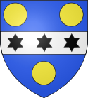
Population Census 1962-2008Blason de la ville de Cherbourg-Octeville (Manche) : d'azur à la fasce d'argent chargée de trois étoiles de six rais de sable, accompagnée de trois besants d'or.
Författare/Upphovsman: Den här vektorbilden skapades med Inkscape av v ., Licens: CC BY-SA 3.0
Gules, two lions passant guardant in pale or armed and langued azure, used as the inofficial "coat of arms of Normandy".
Coat of arms attributed to "Arms of William the Conqueror (William I of England)"Författare/Upphovsman: fr:Utilisateur:Steff, Licens: CC BY-SA 3.0
Aerial view of Cherbourg-Octeville
Författare/Upphovsman:
|
Map data (c) OpenStreetMap contributors, CC-BY-SA  • Shape files infrastructure: railway, highways, water: all originally by OpenStreetMap contributors. Status december 2011 *note: shown commune boundaries are from OSM dump May 2012; at that time about 90% complete |
Map commune FR insee code 50129.png


