Charles Hill, Botswana
| Charles Hill | |
| village | |
| Land | |
|---|---|
| Distrikt | Ghanzi |
| Koordinater | 22°16′35″S 20°5′34″Ö / 22.27639°S 20.09278°Ö |
| Folkmängd | 3 591 (2011)[1] |
| Tidszon | CAT (UTC+2) |
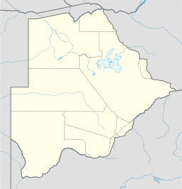
Ortens läge i Botswana | |
Charles Hill är en by i distriktet Ghanzi i västra Botswana[2]. Byn är lokaliserad nära den östra Namibiska gränsen. Byn är den näst största orten i distrikten Ghanzi.[3]
Källor
- ^ ”2011 Botswana Population and Housing Census” (
 PDF). Statistics Botswana. sid. 218. http://www.statsbots.org.bw/sites/default/files/2011%20Population%20and%20Housing%20Census%20%28Results%29.pdf. Läst 21 april 2017.
 - ^ ”Population of Towns Villages and Associated Localities”. 1 augusti 2011. https://www.statsbots.org.bw/sites/default/files/2011%20Population%20and%20Housing%20Census%20(Results).pdf. Läst 6 juli 2023.
- ^ ”Charles Hill Travel Information”. www.botswana-info.com. https://www.botswana-info.com/country/town/1249/charles-hill. Läst 6 juli 2023.
Media som används på denna webbplats
Shiny red button/marker widget. Used to mark the location of something such as a tourist attraction.
Författare/Upphovsman: NordNordWest, Licens: CC BY-SA 3.0
Location map of Botswana


