Central Falls
| Central Falls | |
| Stad (city) | |
| Land | |
|---|---|
| Delstat | |
| County | Providence County |
| Höjdläge | 27 m ö.h. |
| Koordinater | 41°53′24″N 71°23′33″V / 41.89000°N 71.39250°V |
| Area | 3,3 km² (2010)[2] |
| Folkmängd | 22 583 (2020)[3] |
| Befolkningstäthet | 6 839 invånare/km² |
| Borgmästare | Maria Rivera (2021–)[1] |
| Tidszon | EST (UTC-5) |
| - sommartid | EDT (UTC-4) |
| ZIP-kod | 02863 |
| Riktnummer | 401 |
| GNIS-kod | 1218931 |
| Geonames | 5221341 |
Översiktskarta | |
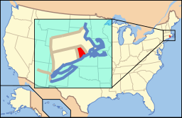
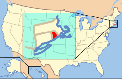
Rhode Islands läge i USA | |
| Wikimedia Commons: Central Falls, Rhode Island | |
| Webbplats: http://www.centralfallsri.us | |
| Redigera Wikidata | |

Central Falls är en stad i Providence County i Rhode Island, med 22 583 invånare (2020). Den har enligt United States Census Bureau en area på 3,3 km².
Kända personer från Central Falls
- Francis Condon, politiker
- Charles Risk, politiker
Referenser
- ^ läs online, www.centralfallsri.gov, läst: 23 juni 2022.[källa från Wikidata]
- ^ United States Census Bureau, 2010 U.S. Gazetteer Files, United States Census Bureau, 2010, läst: 9 juli 2020.[källa från Wikidata]
- ^ United States Census Bureau (red.), USA:s folkräkning 2020, läs online, läst: 1 januari 2022.[källa från Wikidata]
| ||||||||||
|
Media som används på denna webbplats
Författare/Upphovsman: Kenneth C. Zirkel, Licens: CC BY-SA 4.0
Central Falls City Hall is part of the South Central Falls Historic District, Rhode Island.
Map of the municipalities of the U.S. state of Rhode Island, with the city of Central Falls highlighted in red.
Författare/Upphovsman: This version: uploader
Base versions this one is derived from: originally created by en:User:Wapcaplet, Licens: CC BY 2.0
Map of USA with Rhode Island highlighted
Corner of Broad and High Streets, Central Falls, Rhode Island (village of Valley Falls)


