Cavally
| Cavally (Cavalla River) | |
| You, Youbbu, Kavalli, Diougou, River Yubu Dwo, Djougou, Youbou, Diou | |
| Vattendrag | |
| Länder | |
|---|---|
| Koordinater | 4°22′00″N 7°32′00″V / 4.36667°N 7.53333°V |
| Längd | 700 km |
| Flodbäcken | 28 800 km² |
| Tidszon | UTC (UTC+0) |
| Geonames | 2422481 |
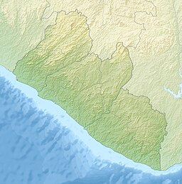
Mynningens läge på en karta över Liberia | |
Cavally eller Cavalla River är ett vattendrag i Guinea och Elfenbenskusten samt längs Liberias gräns.[1] Längs hälften av flodens längd bildar den högra (liberianska) stranden gräns mellan Elfenbenskusten och Liberia.[1][2]
Källor
- ^ [a b] Girard, G.; Sircoulon, J.; Touchebeuf, P. (1971). ”Aperçu sur les régimes hydrologiques”. Le Milieu naturel de la Côte d'Ivoire. Paris: Orstom. sid. 113
- ^ The Geographer (1973). ”Cote D’Ivoire – Liberia Boundary” (på engelska). International Boundary Study (Washington DC: Office of the Geographer, Bureau of Intelligence and Research) 132: sid. 4. http://library.law.fsu.edu/Digital-Collections/LimitsinSeas/pdf/ibs132.pdf. Läst 13 januari 2023.
Media som används på denna webbplats
Flag of the Ivory Coast, written by Jon Harald Søby, modified by Zscout370. The colors match to what is reported at http://fotw.vexillum.com/flags/ci.html.
Shiny red button/marker widget. Used to mark the location of something such as a tourist attraction.
Författare/Upphovsman: Uwe Dedering, Licens: CC BY-SA 3.0
Relief location map of Liberia.
- Projection: Equirectangular projection, strechted by 101.0%.
- Geographic limits of the map:
- N: 8.8° N
- S: 4.0° N
- W: -11.8° E
- E: -7.0° E
- GMT projection: -JX16.933333333333334cd/17.102666666666668cd
- GMT region: -R-11.8/4.0/-7.0/8.8r
- GMT region for grdcut: -R-11.8/4.0/-7.0/8.8r
- Relief: SRTM30plus.
- Made with Natural Earth. Free vector and raster map data @ naturalearthdata.com.
Författare/Upphovsman: Metilsteiner, Licens: CC BY-SA 3.0
Maps of Cavally River.


