Catalina Foothills
| Catalina Foothills | |
| CDP | |
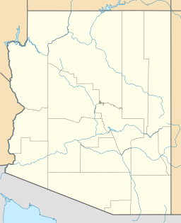
Geografiskt läge i Pima County och delstaten Arizona | |
| Land | |
|---|---|
| Delstat | Arizona |
| County | Pima County |
| Höjdläge | 785 m ö.h. |
| Koordinater | 32°18′6″N 110°53′5″V / 32.30167°N 110.88472°V |
| Yta | 109 km² (2010)[1] |
| - land | 109 km² |
| - vatten | 0,3 km² |
| Folkmängd | 50 796 (2010)[2] |
| Befolkningstäthet | 466 invånare/km² |
| Tidszon | MST (UTC-7) |
| ZIP-kod | 85704, 85712, 85715–85716, 85718, 85749–85750[3] |
| FIPS | 0411230 |
| Geonames | 5288786 |
Ortens läge i Arizona | |
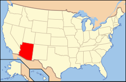
Arizonas läge i USA | |
Catalina Foothills är en tätort i den amerikanska delstaten Arizona med en yta av 115,5 km² och en befolkning, som uppgår till cirka 54 000 invånare (2000). Av befolkningen är cirka 8 procent av latinamerikansk härkomst.
Staden är belägen i den södra delen av delstaten cirka 20 km norr om Tucson, cirka 140 km sydost om huvudstaden Phoenix och cirka 110 km norr om gränsen till Mexiko.
Källor
- ^ ”2010 Census Gazetteer Files”. US Census Bureau. Arkiverad från originalet den 14 juli 2012. https://www.webcitation.org/699nOulzi?url=http://www.census.gov/geo/www/gazetteer/files/Gaz_places_national.txt. Läst 14 juli 2012.
- ^ ”Catalina Foothills CDP, Arizona” (på engelska). State & County Quickfacts. U.S. Census Bureau,. 29 juni 2012. Arkiverad från originalet den 9 juni 2012. https://www.webcitation.org/68IY2t6gf?url=http://quickfacts.census.gov/qfd/states/04/0411230.html. Läst 9 juni 2012.
- ^ ”2010 ZIP Code Tabulation Area (ZCTA) Relationship Files”. U.S. Census Bureau. 24 augusti 2010. Arkiverad från originalet den 25 augusti 2012. https://www.webcitation.org/6ABdwXxbq?url=http://www.census.gov/geo/www/2010census/zcta_rel/zcta_place_rel_10.txt. Läst 25 augusti 2012.
| ||||||||||
Media som används på denna webbplats
Shiny red button/marker widget. Used to mark the location of something such as a tourist attraction.
Författare/Upphovsman: Huebi, Licens: CC BY 2.0
Map of USA with Arizona highlighted
Författare/Upphovsman: NordNordWest, Licens: CC BY-SA 3.0
Location map of Arizona, USA
Författare/Upphovsman: Ixnayonthetimmay, Licens: CC-BY-SA-3.0
This map shows the incorporated areas and unincorporated areas in Pima County, Arizona. Incorporated cities are shown in gray and data for their borders and locations are based on the 2000/2030 PAG Transportation Analysis Zone Map. Catalina Foothills is highlighted in red. Information for unincorporated locations and borders are based on the Census 2000 Pima County Tract Outline Index Map (PDF). I created this map in en:Inkscape.


