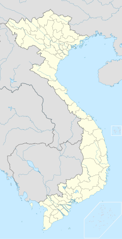
Cat Bi Internationella flygplats
| Cat Bi internationella flygplats | |||||||||||
 | |||||||||||
| Allmän information | |||||||||||
|---|---|---|---|---|---|---|---|---|---|---|---|
| Ort | Hai Phong | ||||||||||
| Flygplatstyp | flygplats | ||||||||||
| IATA-kod | HPH | ||||||||||
| ICAO-kod | VVCI | ||||||||||
| Driftbolag | Airports Corporation of Vietnam | ||||||||||
| Höjd över havet | 4 meter | ||||||||||
| Koordinater | 20°49′09″N 106°43′29″Ö / 20.81917°N 106.72472°Ö | ||||||||||
| Kommunikationer | |||||||||||
| Parkering | Parkeringshus, långtidsparkering, korttidsparkering | ||||||||||
| Trafikerande flygbolag | |||||||||||
| Banor | |||||||||||
| |||||||||||
| Statistik | |||||||||||
| Passagerare (2016) | 1787300 | ||||||||||
Cat Bi internationella flygplats (HPH) är en flygplats i Hai Phong, Vietnam. Flygplatsen kan ta emot medelstora flygplan som Airbus A321, Boeing 737, och har en kapacitet på 1700 000 passagerare per år.CAAV[1] Flygplatsen byggdes ursprungligen av fransmän för militära ändamål.
2017 finns det regelbundna flygningar till Ho Chi Minh-staden, Hanoi, Da Nang, Buon Me Thuot, Pleiku, Phu Quoc, Dong Hoi, Nha Trang, Da Lat, Bangkok, Seoul, Guangzhou.
Källor
- ^ ”Khởi công dự án "Xây dựng nhà ga hành khách – Cảng HKQT Cát Bi"”. Airports Corporation of Vietnam. Arkiverad från originalet den 6 februari 2015. https://web.archive.org/web/20150206114450/http://vietnamairport.vn/page/1369/tin-tuc-va-su-kien/khoi-cong-du-an-%E2%80%9Cxay-dung-nha-ga-hanh-khach-%E2%80%93-cang-hkqt-cat-bi%E2%80%9D. Läst 7 maj 2015.
| ||||||||||||||
Media som används på denna webbplats
Shiny red button/marker widget. Used to mark the location of something such as a tourist attraction.
Författare/Upphovsman: Uwe Dedering, Licens: CC BY-SA 3.0
Location map of Vietnam.
Equirectangular projection. Strechted by 104 %. Geographic limits of the map:
- N: 24.0° N
- S: 8.0° N
- W: 101.8° E
- E: 110.3° E
Paracel Islands (map between). Equirectangular projection. Stretched by 52%. Geographic limits of the map:
- N: 17°15′ N
- S: 15°45′ N
- W: 111°00′ E
- E: 113°00′ E
Spratly Islands (map below). Equirectangular projection. Stretched by 41.6%. Geographic limits of the map:
- N: 12°00' N
- S: 6°12' N
- W: 111°30' E
- E: 117°20' E
Författare/Upphovsman: Challenger2016, Licens: CC BY-SA 4.0
Cat Bi International Airport


