Carbon County, Utah
| Carbon County | |
| County | |
Desolation Canyon | |
| Land | |
|---|---|
| Delstat | |
| Huvudort | Price |
| Största stad | Price |
| Area | 3 845 km² (2010)[1] |
| - land | 3 829 km² (100%) |
| - vatten | 15,8 km² (0%) |
| Folkmängd | 21 403 (2010)[2] |
| Befolkningstäthet | 5,6 invånare/km² |
| Grundat | 1894 |
| Tidszon | MST (UTC-7) |
| - sommartid | MDT (UTC-6) |
| FIPS-kod | 49007 |
| Geonames | 5536454 |
Läge i delstaten Utah. | |
Delstatens läge i USA. | |
| Fotnoter: Naco - Find a county | |
Carbon County är ett administrativt område i delstaten Utah, USA. År 2010 hade countyt 21 403 invånare. Den administrativa huvudorten (county seat) är Price.
Geografi
Enligt United States Census Bureau har countyt en total area på 3 845 km². 3 829 km² av den arean är land och 16 km² är vatten.
Angränsande countyn
- Utah County, Utah - nordväst
- Duchesne County, Utah - nord
- Emery County, Utah - syd
- Uintah County, Utah - öst
- Sanpete County, Utah - väst
- Grand County, Utah - sydöst
Källor
- ^ ”2010 Census U.S. Gazetteer Files for Counties”. U.S. Census Bureau. Arkiverad från originalet den 5 juli 2012. https://www.webcitation.org/68vYLbou5?url=http://www.census.gov/geo/www/gazetteer/files/Gaz_counties_national.txt. Läst 5 juli 2012.
- ^ ”State & County QuickFacts, Carbon County, Utah” (på engelska). U.S. Census Bureau. Arkiverad från originalet den 8 juli 2011. https://www.webcitation.org/601CWgKry?url=http://quickfacts.census.gov/qfd/states/49/49007.html. Läst 6 juli 2011.
| ||||||||||
Media som används på denna webbplats
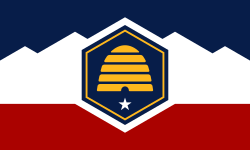
The flag of Utah (2024-present). This is the final design submitted for consideration to be adopted as a new state flag of Utah. The design evokes images of snowy mountains and red rocks to represent the geography of Utah, the beehive represents "Industry" (the state's slogan) and Utah's nickname as "the Beehive State".
Författare/Upphovsman: This version: uploader
Base versions this one is derived from: originally created by en:User:Wapcaplet, Licens: CC BY 2.0
Map of USA with Utah highlighted
This is a locator map showing Carbon County in Utah. For more information, see Commons:United States county locator maps.
Desolation Canyon, Utah.
|
This is an image of a place or building that is listed on the National Register of Historic Places in the United States of America. Its reference number is 68000057. |


