Calhoun County, Texas
| Calhoun County | |
| County | |
(c) Larry D. Moore, CC BY 4.0 Calhoun Countys domstolshus i Port Lavaca. | |
| Land | |
|---|---|
| Delstat | |
| Huvudort | Port Lavaca |
| Area | 2 675 km² (2010)[1] |
| - land | 1 313 km² (49%) |
| - vatten | 1 362 km² (51%) |
| Folkmängd | 21 381 (2010)[2] |
| Befolkningstäthet | 16 invånare/km² |
| Grundat | 1846 |
| Tidszon | CST (UTC-6) |
| - sommartid | CDT (UTC-5) |
| FIPS-kod | 48057 |
| Geonames | 4678165 |
 Läge i delstaten Texas. | |
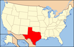
Delstatens läge i USA. | |
Calhoun County är ett county i sydöstra delen av delstaten Texas vid Mexikanska golfen cirka 140 km sydväst om Houston. År 2010 hade countyt 21 381 invånare. Den administrativa huvudorten (county seat) är Port Lavaca. Countyt har fått sitt namn efter USA:s sjunde vicepresident John C. Calhoun.
Geografi
Enligt United States Census Bureau har countyt en total area på 2 673 km². 1 327 km² av den arean är land och 1 346 km² är vatten.
Angränsande countyn
- Jackson County - norr
- Matagorda County - öst
- Mexikanska golfen - sydost
- Aransas County - sydväst
- Refugio County - väst
- Victoria County - nordväst
Städer och samhällen
- Alamo Beach
- Indianola
- Magnolia Beach
- Point Comfort
- Port Lavaca
- Seadrift
Källor
- ^ ”2010 Census U.S. Gazetteer Files for Counties”. U.S. Census Bureau. Arkiverad från originalet den 5 juli 2012. https://www.webcitation.org/68vYLbou5?url=http://www.census.gov/geo/www/gazetteer/files/Gaz_counties_national.txt. Läst 5 juli 2012.
- ^ ”State & County QuickFacts, Calhoun County, Texas” (på engelska). U.S. Census Bureau. Arkiverad från originalet den 8 juli 2011. https://www.webcitation.org/6019mNUde?url=http://quickfacts.census.gov/qfd/states/48/48057.html. Läst 6 juli 2011.
Externa länkar
 Wikimedia Commons har media som rör Calhoun County, Texas.
Media som används på denna webbplats
Författare/Upphovsman: This version: uploader
Base versions this one is derived from: originally created by en:User:Wapcaplet, Licens: CC BY 2.0
Map of USA with Texas highlighted
(c) Larry D. Moore, CC BY 4.0
The Calhoun County Courthouse in Port Lavaca, Texas, United States was built in 1959.
This is a locator map showing Calhoun County in Texas. For more information, see Commons:United States county locator maps.


