Bronson, Michigan
| Bronson | |
| city | |
Flygbild över Bronson. | |
| Land | |
|---|---|
| Delstat | Michigan |
| County | Branch County |
| Höjdläge | 278 m ö.h. |
| Koordinater | 41°52′20″N 85°11′41″V / 41.87222°N 85.19472°V |
| Yta | 3,55 km² (2010) |
| - land | 3,55 km² |
| - vatten | 0,0 km² |
| Folkmängd | 2 349 (2010) |
| Befolkningstäthet | 662 invånare/km² |
| Tidszon | EST (UTC-5) |
| - sommartid | EDT (UTC-4) |
| ZIP-kod | 49028 |
| Riktnummer | 517 |
| FIPS | 2610860 |
| Geonames | 4987045 |
Ortens läge i Michigan | |
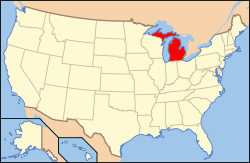
Michigans läge i USA | |
| Webbplats: http://www.bronson-mi.com/ | |
Bronson är en ort i Branch County i Michigan.[1] Enligt 2010 års folkräkning hade Bronson då 2 349 invånare.[2]
Källor
- ^ Bronson, MI. Map Quest. Läst 26 september 2018.
- ^ 2010 Census Population of Bronson, Michigan Arkiverad 26 september 2018 hämtat från the Wayback Machine.. Census Viewer. Läst 26 september 2018.
|
Media som används på denna webbplats
Shiny red button/marker widget. Used to mark the location of something such as a tourist attraction.
Författare/Upphovsman: Alexrk2, Licens: CC BY 3.0
Den här Det karta skapades med GeoTools.
Författare/Upphovsman:
| This media | uploader |
|---|---|
| Original work | en:User:Wapcaplet |
Map of USA with Michigan highlighted
Författare/Upphovsman: Ken Lund from Reno, Nevada, USA, Licens: CC BY-SA 2.0
Bronson is a city located in west central Branch County in the U.S. state of Michigan. The population was 2,349 at the 2010 census. Bronson is situated on U.S. Highway 12 about 12 miles (19 km) southwest of Coldwater. The city is located within Bronson Township, though it is administratively autonomous.
en.wikipedia.org/wiki/Bronson,_Michigan
en.wikipedia.org/wiki/Wikipedia:Text_of_Creative_Commons_...


