Bridgeport, New Jersey
| Bridgeport, New Jersey | |
| Ort | |
| Land | |
|---|---|
| Delstat | |
| County | Gloucester County |
| Township i New Jersey | Logan Township |
| Höjdläge | 7 m ö.h. |
| Koordinater | 39°48′4″N 75°20′42″V / 39.80111°N 75.34500°V |
| Folkmängd | 389 (2020)[1] |
| Tidszon | EST (UTC-5) |
| - sommartid | EDT (UTC-4) |
| ZIP-kod | 08014 |
| GNIS-kod | 2806056 |
| Geonames | 4500911 |
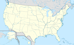
Ortens läge i USA | |
| Redigera Wikidata | |
Bridgeport är ett kommunfritt område inom Logan Township, beläget i Gloucester County, New Jersey.
Bridgeport är tillsammans med Swedesboro en av blott två bosättningar i New Jersey som grundades som en del av kolonin Nya Sverige, vid fästningen Nya Elfsborg. Bridgeport kallades ursprungligen Nya Stockholm, men ändrades senare till det nuvarande namnet.[2]
Referenser
- ^ United States Census Bureau (red.), USA:s folkräkning 2020, läs online, läst: 1 januari 2022.[källa från Wikidata]
- ^ The Swedes and Finns in New Jersey (Federal Writers' Project of WPA. Bayonne, New Jersey: Jersey Printing Company, Inc. 1938)
Externa länkar
Media som används på denna webbplats
Shiny red button/marker widget. Used to mark the location of something such as a tourist attraction.
Författare/Upphovsman: Ken Lund from Reno, Nevada, USA, Licens: CC BY-SA 2.0
Bridgeport is an unincorporated community within Logan Township, Gloucester County, New Jersey, United States. Bridgeport, along with Swedesboro, was one of only two settlements established in New Jersey as a part of the New Sweden colony, the fort at Nya Elfsborg having been abandoned. It was originally called New Stockholm, but the name was changed at a later date. The Commodore Barry Bridge spanning the Delaware River is seen in the top portion of the photo.
Författare/Upphovsman: TUBS
Location map of the USA (Hawaii and Alaska shown in sidemaps).
Main map: EquiDistantConicProjection : Central parallel :
* N: 37.0° N
Central meridian :
* E: 96.0° W
Standard parallels:
* 1: 32.0° N
* 2: 42.0° N
Made with Natural Earth. Free vector and raster map data @ naturalearthdata.com.
Formulas for x and y:
x = 50.0 + 124.03149777329222 * ((1.9694462586094064-({{{2}}}* pi / 180))
      * sin(0.6010514667026994 * ({{{3}}} + 96) * pi / 180))
y = 50.0 + 1.6155950752393982 * 124.03149777329222 * 0.02613325650382181
      - 1.6155950752393982  * 124.03149777329222 *
     (1.3236744353715044  - (1.9694462586094064-({{{2}}}* pi / 180))
      * cos(0.6010514667026994 * ({{{3}}} + 96) * pi / 180))
Hawaii side map: Equirectangular projection, N/S stretching 107 %. Geographic limits of the map:
- N: 22.4° N
- S: 18.7° N
- W: 160.7° W
- E: 154.6° W
Alaska side map: Equirectangular projection, N/S stretching 210.0 %. Geographic limits of the map:
- N: 72.0° N
- S: 51.0° N
- W: 172.0° E
- E: 129.0° W


