Breklum
| Breklum | |||
| Kommun | |||
Kyrka i Breklum. | |||
| |||
| Land | |||
|---|---|---|---|
| Förbundsland | Schleswig-Holstein | ||
| Kreis | Nordfriesland | ||
| Förvaltningsgemenskap | Amt Mittleres Nordfriesland | ||
| Höjdläge | 7 m ö.h. | ||
| Koordinater | 54°36′21″N 8°58′58″Ö / 54.60588°N 8.98283°Ö | ||
| Yta | 10,07 km² ()[1] | ||
| Folkmängd | 2 281 ()[2] | ||
| Befolkningstäthet | 227 inv./km² | ||
| Postnummer | 25821 | ||
| Riktnummer | (+49) 04671 | ||
| Registreringsskylt | NF | ||
| Kommunkod | 01 0 54 020 | ||
| Geonames | 6551538 | ||
| OSM-karta | 1571761 | ||
Läget för Breklum i Tyskland | |||
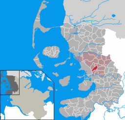
Läget för kommunen Breklum i Kreis Nordfriesland | |||
| Webbplats: Breklum | |||
Breklum är en kommun och ort i Kreis Nordfriesland i förbundslandet Schleswig-Holstein i Tyskland.
Kommunen ingår i kommunalförbundet Amt Mittleres Nordfriesland tillsammans med ytterligare 18 kommuner.[3]
Referenser
- ^ Alle politisch selbständigen Gemeinden mit ausgewählten Merkmalen am 31.12.2018 (4. Quartal) (på tyska), Statistisches Bundesamt, läs online, läst: 10 mars 2019.[källa från Wikidata]
- ^ Alle politisch selbständigen Gemeinden mit ausgewählten Merkmalen am 31.12.2023, Statistisches Bundesamt, 28 oktober 2024, läs online, läst: 16 november 2024.[källa från Wikidata]
- ^ ”Alle politisch selbständigen Gemeinden mit ausgewählten Merkmalen am 31.03.2020” (Excel). Statistisches Bundesamt. 2020. https://www.destatis.de/DE/Themen/Laender-Regionen/Regionales/Gemeindeverzeichnis/Administrativ/Archiv/GVAuszugQ/AuszugGV1QAktuell.xlsx?__blob=publicationFile. Läst 23 juli 2020.
|
Media som används på denna webbplats
Författare/Upphovsman: TUBS
Location map of Germany with waterbodies
Shiny red button/marker widget. Used to mark the location of something such as a tourist attraction.
Författare/Upphovsman: Goegeo, Licens: CC BY-SA 3.0
Ev.-luth. church Sunte Oluf (St. Olav) in Breklum, Germany
Flagge Breklum


