Brandon, Mississippi
- För andra betydelser, se Brandon.
| Brandon | |||
| City | |||
Domstolsbyggnaden och Rankin County Confederate Monument i Brandon. | |||
| |||
| Officiellt namn: City of Brandon | |||
| Etymologi: Gerard Brandon[1] | |||
| Motto: Growth and Stability | |||
| Land | |||
|---|---|---|---|
| Delstat | |||
| County | Rankin County | ||
| Höjdläge | 144 m ö.h.[1] | ||
| Koordinater | 32°16′24″N 89°59′09″V / 32.27333°N 89.98583°V | ||
| Area | 66,70 km² (2021)[2] | ||
| - land | 66,47 km² (100%)[2] | ||
| - vatten | 0,23 km² (0%)[2] | ||
| Folkmängd | 25 138 (2020)[3] | ||
| Befolkningstäthet | 378 inv./km² | ||
| Grundad | 1820-talet[4] | ||
| - Stadsprivilegier | 19 december 1831[5] | ||
| Tidszon | CST (UTC-6) [6] | ||
| - sommartid | CDT (UTC-5) [6] | ||
| Postnummer | 39042–39043, 39047 [6] | ||
| Riktnummer | 601, 769 [6] | ||
| FIPS-kod | 28-08300 [2] | ||
| GNIS-kod | 667519 [1] | ||
| Geonames | 4419290 | ||
Brandons läge i Rankin County och countyts läge i Mississippi. | |||
Mississippis läge i USA. | |||
| Wikimedia Commons: Brandon, Mississippi | |||
| Statistik: United States Census Bureau | |||
| Webbplats: Officiell webbplats | |||
Brandon är en stad (city) som är administrativ huvudort i Rankin County i Mississippi i USA.[7]
Brandon grundades på 1820-talet[4] och fick stadsprivilegier 1831[5]. Orten har fått sitt namn efter Gerard Brandon, Mississippis guvernör vid tidpunkten för grundandet.[1]
Vid 2020 års folkräkning hade Brandon 25 138 invånare.[3] Orten ingår i Jacksons storstadsområde (metropolitan statistical area).[8]
Kända personer
- Justin Mapp, fotbollsspelare
- Anselm J. McLaurin, politiker
Referenser
- ^ [a b c d] ”Geographic Names Information System” (på engelska). United States Geological Survey. https://edits.nationalmap.gov/apps/gaz-domestic/public/summary/667519. Läst 28 juni 2022.
- ^ [a b c d] ”2021 U.S. Gazetteer Files” (på engelska). United States Census Bureau. Arkiverad från originalet den 16 oktober 2021. https://web.archive.org/web/20211016042447/https://www2.census.gov/geo/docs/maps-data/data/gazetteer/2021_Gazetteer/2021_gaz_place_28.txt. Läst 28 juni 2022.
- ^ [a b] ”Brandon city, Mississippi” (på engelska). United States Census Bureau. https://data.census.gov/cedsci/profile?g=1600000US2808300. Läst 28 juni 2022.
- ^ [a b] ”History of Brandon” (på engelska). City of Brandon. Arkiverad från originalet den 26 april 2022. https://web.archive.org/web/20220426083853/https://www.brandonms.org/experience-brandon/history-of-brandon/. Läst 28 juni 2022.
- ^ [a b] ”Value Station, Mississippi – Brandon, Mississippi” (på engelska). Mississippi Rails. Arkiverad från originalet den 11 januari 2020. https://web.archive.org/web/20200111071410/https://www.msrailroads.com/Towns/Brandon.htm. Läst 28 juni 2022.
- ^ [a b c d] ”Brandon, Mississippi” (på engelska). Citytowninfo.com. Arkiverad från originalet den 28 juni 2022. https://web.archive.org/web/20220628204917/https://www.citytowninfo.com/places/mississippi/brandon. Läst 28 juni 2022.
- ^ ”Mississippi County Map with County Seat Cities” (på engelska). Geology.com. Arkiverad från originalet den 7 april 2022. https://web.archive.org/web/20220407170132/https://geology.com/county-map/mississippi.shtml. Läst 28 juni 2022.
- ^ ”Mississippi: 2020 Core Based Statistical Areas and Counties” (på engelska) (PDF). United States Census Bureau. Arkiverad från originalet den 16 mars 2022. https://web.archive.org/web/20220316230706/https://www2.census.gov/programs-surveys/metro-micro/reference-maps/2020/state-maps/28_Mississippi_2020.pdf. Läst 28 juni 2022.
Externa länkar
 Wikimedia Commons har media som rör Brandon.
- Officiell webbplats
|
Media som används på denna webbplats
Författare/Upphovsman: Arkyan, Licens: CC BY-SA 3.0
This map shows the incorporated and unincorporated areas in Rankin County, Mississippi, highlighting Brandon in red. It was created with a custom script with US Census Bureau data and modified with Inkscape.
Författare/Upphovsman: Nathan Yow, Licens: CC BY-SA 4.0
Brandon City logo
Författare/Upphovsman: Ditch Fisher, Licens: CC BY-SA 3.0
Rankin County Confederate Monument with historic courthouse in background
Författare/Upphovsman: This version: uploader
Base versions this one is derived from: originally created by en:User:Wapcaplet, Licens: CC BY 2.0
Map of USA with Mississippi highlighted
Författare/Upphovsman: Rocky Vaughn, Sue Anna Joe, Dominique Pugh, Clay Moss, Kara Giles, Micah Whitson and the Mississippi Department of Archives and History, Licens: Copyrighted free use
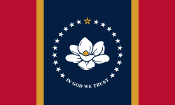
The flag of the U.S. state of Mississippi - aspect ratio of 5:3. Designed in 2020 and adopted in 2021, the "New Magnolia" flag was selected by the Commission to Redesign the Mississippi state flag in 2020.
Författare/Upphovsman: Nathan Yow, Licens: CC BY-SA 4.0
The center is the seal with the stripes are meant to resemble the stripes on the Mississippi state flag.


