Brandon, Florida
| Brandon | |
| CDP | |
Lägeskarta | |
| Land | |
|---|---|
| Delstat | Florida |
| County | Hillsborough County |
| Höjdläge | 14 m ö.h. |
| Koordinater | 27°56′9″N 82°17′57″V / 27.93583°N 82.29917°V |
| Yta | 90,6 km² (2010)[1] |
| - land | 85,7 km² |
| - vatten | 4,9 km² |
| Folkmängd | 103 483 (2010)[2] |
| Befolkningstäthet | 1 208 invånare/km² |
| Tidszon | EST (UTC-5) |
| - sommartid | EDT (UTC-4) |
| ZIP-kod | 33510–33511, 33527, 33578, 33584, 33594, 33596, 33619[3] |
| FIPS | 1208150 |
| Geonames | 4148757 |
Ortens läge i Florida | |
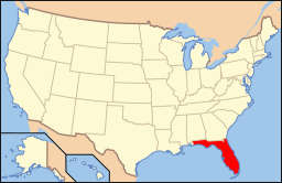
Floridas läge i USA | |
Brandon är en ort strax utanför Tampa i Hillsborough County, Florida. Vid folkräkningen 2000 hade orten en folkmängd på 77 895 invånare. 2007 hade folkmängden ökat till 90 470, en ökning på 16,1%.[4] I Brandon ligger köpcentrumet Westfield Shopping Center Mall (tidigare Brandon Town Center).
Källor
- ^ ”2010 Census Gazetteer Files”. US Census Bureau. Arkiverad från originalet den 14 juli 2012. https://www.webcitation.org/699nOulzi?url=http://www.census.gov/geo/www/gazetteer/files/Gaz_places_national.txt. Läst 14 juli 2012.
- ^ ”Brandon CDP, Florida” (på engelska). State & County Quickfacts. U.S. Census Bureau,. Arkiverad från originalet den 2 juli 2012. https://www.webcitation.org/68rWdhCzL?url=http://quickfacts.census.gov/qfd/states/12/1208150.html. Läst 2 juli 2012.
- ^ ”2010 ZIP Code Tabulation Area (ZCTA) Relationship Files”. U.S. Census Bureau. 15 februari 2010. Arkiverad från originalet den 25 augusti 2012. https://www.webcitation.org/6ABdwXxbq?url=http://www.census.gov/geo/www/2010census/zcta_rel/zcta_place_rel_10.txt. Läst 25 augusti 2012.
- ^ ”American Fact Finder”. U.S. Census Bureau. Arkiverad från originalet den 10 februari 2020. https://archive.today/20200210212716/http://factfinder.census.gov/servlet/ADPTable?_bm=y&-geo_id=16000US1208150&-qr_name=ACS_2007_1YR_G00_DP5&-context=adp&-ds_name=ACS_2007_1YR_G00_&-tree_id=306&-_lang=en&-redoLog=false&-format=. Läst 18 januari 2009.
Media som används på denna webbplats
Shiny red button/marker widget. Used to mark the location of something such as a tourist attraction.
Författare/Upphovsman: Arkyan, Licens: CC BY-SA 3.0
This map shows the incorporated and unincorporated areas in Hillsborough County, Florida, highlighting Brandon in red. It was created with a custom script with US Census Bureau data and modified with Inkscape.
Författare/Upphovsman: This version: en:User:Huebi
Base versions this one is derived from: originally created by en:User:Wapcaplet, Licens: CC BY 2.0
Map of USA with Florida highlighted


