Bowling Green, Ohio
| Bowling Green | |
| city | |
Main Street | |
| Land | |
|---|---|
| Delstat | Ohio |
| County | Wood County |
| Höjdläge | 212 m ö.h. |
| Koordinater | 41°22′29″N 83°39′5″V / 41.37472°N 83.65139°V |
| Yta | 32,66 km² (2010) |
| - land | 32,53 km² |
| - vatten | 0,13 km² |
| Folkmängd | 30 028 (2010) |
| Befolkningstäthet | 923 invånare/km² |
| Tidszon | EST (UTC-5) |
| - sommartid | EDT (UTC-4) |
| ZIP-kod | 43402–43403 |
| Riktnummer | 419/567 |
| FIPS | 3907972 |
| Geonames | 5147968 |
Ortens läge i Ohio | |
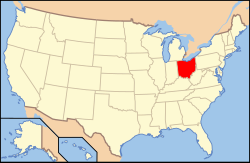
Ohios läge i USA | |
| Webbplats: http://www.bgohio.org/ | |
Bowling Green är administrativ huvudort i Wood County i delstaten Ohio.[1][2] Orten har fått sitt namn efter Bowling Green i Kentucky.[3] Enligt 2010 års folkräkning hade Bowling Green 30 028 invånare.[4] Bowling Green är säte för Bowling Green State University.[5]
Källor
- ^ Ohio County Map with County Seat Cities. Geology.com Geoscience News and Information. Läst 16 december 2016.
- ^ Bowling Green, OH. Map Quest. Läst 16 december 2016.
- ^ Profile for Bowling Green, Ohio. ePodunk. Läst 16 december 2016.
- ^ 2010 Census Population of Bowling Green, Ohio Arkiverad 20 december 2016 hämtat från the Wayback Machine.. Census Viewer. Läst 16 december 2016.
- ^ About BGSU. Bowling Green State University. Läst 16 december 2016.
|
Media som används på denna webbplats
Shiny red button/marker widget. Used to mark the location of something such as a tourist attraction.
Författare/Upphovsman: This version: uploader
Base versions this one is derived from: originally created by en:User:Wapcaplet, Licens: CC BY 2.0
Map of USA with Ohio highlighted
Författare/Upphovsman: The original uploader was Wapcaplet på engelska Wikipedia., Licens: CC BY-SA 3.0
Photograph taken in Bowling Green looking southward down Main Street, at the intersection of Main and Wooster. On the right is Easystreet Cafe, the Huntington National Bank, Ace Hardware and Ben Franklin Crafts. On the left is the old Millikin hotel (converted into apartments). Photo taken by Wapcaplet in July 2003.
Författare/Upphovsman: Alexrk2, Licens: CC BY 3.0
Den här Det karta skapades med GeoTools.


