Boucau
| Boucau | |
| Kommun | |
| Land | |
|---|---|
| Region | Nouvelle-Aquitaine |
| Departement | |
| Arrondissement | Bayonne |
| Kanton | Bayonne-Nord |
| Koordinater | 43°32′N 1°30′V / 43.533°N 1.500°V |
| Yta | 5,82 km²[1] |
| Folkmängd | 8 934 ()[2] |
| Befolkningstäthet | 1 535 invånare/km² |
| Tidszon | CET (UTC+1) |
| - sommartid | CEST (UTC+2) |
| Postnummer | 64340 |
| INSEE | 64140 |
| Geonames | 3031389 |
| OSM-karta | 76018 |
 Kommunens läge i regionen Nouvelle-Aquitaine i Frankrike | |
| Webbplats: http://www.boucau.fr | |

Boucau (baskiska: Bokale) är en kommun i departementet Pyrénées-Atlantiques i regionen Nouvelle-Aquitaine i sydvästra Frankrike. Kommunen ligger i kantonen Bayonne-Nord som tillhör arrondissementet Bayonne. År 2022 hade Boucau 8 934 invånare.
Befolkningsutveckling
Antalet invånare i kommunen Boucau
 Referens: INSEE[3] |
Se även
Källor
- ^ Répertoire géographique des communes, Institut national de l'information géographique et forestière, läst: 26 oktober 2015.[källa från Wikidata]
- ^ Populations légales 2022, Institut National de la Statistique et des Études Économiques, 19 december 2024.[källa från Wikidata]
- ^ Chiffres clés - Évolution et structure de la population hämtat från the Wayback Machine (arkiverat 4 maj 2012).
Externa länkar
 Wikimedia Commons har media som rör Boucau.
Media som används på denna webbplats
(c) I, Peter Potrowl, CC BY 3.0
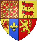
Coat of arms of the French departement Pyrénées-Atlantiques (64)
Författare/Upphovsman: Eric Gaba (Sting - fr:Sting), Licens: CC BY-SA 4.0
Blank physical map of metropolitan France for geo-location purpose.
Scale : 1:14 816 000 (accuracy : about 3,7 km) for the bathymetry. More maps of France, view → Commons Atlas of France.
Shiny red button/marker widget. Used to mark the location of something such as a tourist attraction.
Författare/Upphovsman:
|
Map data (c) OpenStreetMap contributors, CC-BY-SA  • Shape files infrastructure: railway, highways, water: all originally by OpenStreetMap contributors. Status december 2011 *note: shown commune boundaries are from OSM dump May 2012; at that time about 90% complete |
Map commune FR insee code 64140.png
Författare/Upphovsman: Michiel1972, Licens: CC BY-SA 3.0
Population - Municipality code 64140.svg
Population Census 1962-2008Författare/Upphovsman: The original uploader was Khardan på franska Wikipedia., Licens: CC BY-SA 2.0 fr
- Description:Porche ouest du bois Guilhou
- Lieu:fr:Boucau - Pyrénées-Atlantiques (64)
- Date:Août 2005
- Auteur:
- Licence:CC-BY-SA FR 2.0 ()


