Bouéni
| Bouéni | |
| Kommun | |
Solnedgång i Bouéni | |
| Land | |
|---|---|
| Region | Mayotte |
| Departement | Mayotte |
| Kanton | Bouéni |
| Koordinater | 12°54′39″S 45°04′48″Ö / 12.91083°S 45.08000°Ö |
| Yta | 14,29 km²[1] |
| Folkmängd | 6 189 ()[2] |
| Befolkningstäthet | 433 invånare/km² |
| Tidszon | CET (UTC+1) |
| - sommartid | CEST (UTC+2) |
| Postnummer | 97620 |
| INSEE | 97604 |
| Geonames | 7521424 |
| OSM-karta | 3366523 |
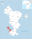
 Läge i regionen Mayotte | |

Bouéni är en kommun i det franska utomeuropeiska departementet Mayotte i Indiska oceanen. År 2017 hade Bouéni 6 189 invånare.
Byar
Kommunen Bouéni delas i följande byar (folkmängd 2007 inom parentes):
- Bouéni (2 027)
- Moinatrindri (873)
- Hagnoundrou (789)
- Bambo Ouest (327)
- Mzouazia (1 108)
- Mbouanatsa (172)
Se även
Referenser
- ^ Répertoire géographique des communes, Institut national de l'information géographique et forestière, läst: 26 oktober 2015, licens: öppen licens.[källa från Wikidata]
- ^ Recensement de la population 2017 de Mayotte, Institut National de la Statistique et des Études Économiques (på franska), 27 december 2017.[källa från Wikidata]
Externa länkar
 Wikimedia Commons har media som rör Bouéni.
| |||||||
Media som används på denna webbplats
Shiny red button/marker widget. Used to mark the location of something such as a tourist attraction.
Författare/Upphovsman: Germenfer, Licens: CC0
New local unofficial representative flag of Mayotte.
Författare/Upphovsman: Tschubby, Licens: CC BY-SA 3.0
Lage der Gemeinde Bouéni
Författare/Upphovsman: Rémi Kaupp, Licens: CC BY-SA 4.0
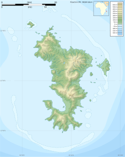
Topographic blank map of Mayotte. Use the PNG version in articles for faster loading.
Författare/Upphovsman: Christophe Laborderie, Licens: CC BY 2.0
Coucher de soleil sur la plage Robinson, près de Boueni, à Mayotte


