Bomi County
| Bomi County | ||
| Bomi | ||
| Region | ||
Bomi lake | ||
| ||
| Land | ||
|---|---|---|
| Koordinater | 6°44′00″N 10°49′00″V / 6.73333°N 10.81667°V | |
| Huvudort | Tubmanburg | |
| Area | 1 932 km² | |
| Folkmängd | 133 705 (2022)[1] | |
| Befolkningstäthet | 69 invånare/km² | |
| Tidszon | UTC (UTC+0) | |
| ISO 3166-2-kod | LR-BM | |
| Geonames | 2278324 | |
Läge i Liberia | ||
Bomi County är en region i Liberia.[1] Den ligger i den västra delen av landet, 50 km norr om huvudstaden Monrovia. Antalet invånare var 133 705 vid folkräkningen 2022.[1] Arean är 1 932 kvadratkilometer.
Styre och politik
Bomi County delas in i fyra administrativa distrikt, fem hövdingadömen och 18 klaner.
Administrativa distrikt: Klay, Dewien, Suehn Mecca och Senjeh.[2]
Hövdingadömen: Klay, Deygbo, Blugbah, Senjeh och Suehn Mecca.[2]
Klaner: Gbojay, Gbore, Upper Mecca, Lower Mecca, Upper Zor, Lower Zor, Gbarvon, Kpitia, Mohfah, Deygbo, Tehr, Kpo, Goblah, Manna, Upper Togay, Lower Togay, Zepeh och Manoah.[2]
Tubmanburg är countyts huvudstad.[2]
Källor
- ^ [a b c] ”2022 Liberia Population and Housing Census: Final Results” (på engelska) (PDF). Liberia Institute of Statistics and Geo-Information Services. Juni 2023. sid. 84. Arkiverad från originalet den 12 augusti 2024. https://web.archive.org/web/20240812104604/https://www.lisgis.gov.lr/document/LiberiaCensus2022Report.pdf. Läst 16 september 2024.
- ^ [a b c d] County Development Committee, in collaboration with the Ministries of Planning and Economic Affairs and Internal Affairs. (2008). Bomi County Development Agenda. Arkiverad från originalet den 10 juni 2022. https://web.archive.org/web/20220610174515/https://mia.gov.lr/doc/Bomi%20CDA_web.pdf. Läst 16 april 2022.
Externa länkar
 Wikimedia Commons har media som rör Bomi County.
Media som används på denna webbplats
Shiny red button/marker widget. Used to mark the location of something such as a tourist attraction.
Författare/Upphovsman: Uwe Dedering, Licens: CC BY-SA 3.0
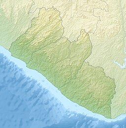
Relief location map of Liberia.
- Projection: Equirectangular projection, strechted by 101.0%.
- Geographic limits of the map:
- N: 8.8° N
- S: 4.0° N
- W: -11.8° E
- E: -7.0° E
- GMT projection: -JX16.933333333333334cd/17.102666666666668cd
- GMT region: -R-11.8/4.0/-7.0/8.8r
- GMT region for grdcut: -R-11.8/4.0/-7.0/8.8r
- Relief: SRTM30plus.
- Made with Natural Earth. Free vector and raster map data @ naturalearthdata.com.
Författare/Upphovsman: Mr Accountable, Licens: CC BY-SA 3.0
Map showing location of Bomi County in Liberia
Lake Bomi, Tubmanburg, Liberia
Författare/Upphovsman: Fry1989, Licens: CC BY-SA 3.0
Flag of the Liberian County of Bomi.


