Bojnurd
| Bojnurd (بجنورد) | |
| Stad | |
Besh Qardash i stadens utkant. | |
| Land | |
|---|---|
| Provins | Nordkhorasan |
| Shahrestan | Bojnurd |
| Koordinater | 37°28′19″N 57°19′44″Ö / 37.47194°N 57.32889°Ö |
| Folkmängd | 228 931 (24 september 2016)[1] |
| Geonames | 140380 |
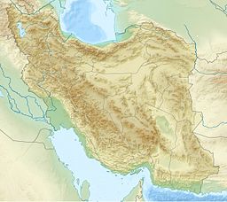
Bojnurds läge på karta över Iran. | |
Bojnurduttal (persiska بُجنورد), eller Bojnourd, är en stad i nordöstra Iran. Den är administrativ huvudort för delprovinsen Bojnurd och för provinsen Nordkhorasan och har cirka 230 000 invånare.
Källor
- ^ www.amar.org.ir; Resultat från folkräkningen i Iran 2016 Läst 24 juni 2016.
Media som används på denna webbplats
Flag of Iran. The tricolor flag was introduced in 1906, but after the Islamic Revolution of 1979 the Arabic words 'Allahu akbar' ('God is great'), written in the Kufic script of the Qur'an and repeated 22 times, were added to the red and green strips where they border the white central strip and in the middle is the emblem of Iran (which is a stylized Persian alphabet of the Arabic word Allah ("God")).
The official ISIRI standard (translation at FotW) gives two slightly different methods of construction for the flag: a compass-and-straightedge construction used for File:Flag of Iran (official).svg, and a "simplified" construction sheet with rational numbers used for this file.
Författare/Upphovsman: Uwe Dedering, Licens: CC BY-SA 3.0
Topographic map of the Iranian plateau in Central Asia, connecting to Anatolia in the west and Hindu Kush and Himalaya in the east.
Shiny red button/marker widget. Used to mark the location of something such as a tourist attraction.
Författare/Upphovsman: Mårten Mellberg, Licens: CC BY-SA 4.0
Uttal av staden Bojnourd på persiska


