Bleka
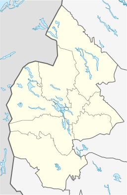
Bleka är en by i Lockne distrikt (Lockne socken) i Östersunds kommun, Jämtlands län (Jämtland). Byn ligger väster om Locknesjön, vid länsväg 559, cirka två kilometer österut från tätorten Tandsbyn.[1][2]
Referenser
| |||||||||||||||||||
Media som används på denna webbplats
Författare/Upphovsman: Erik Frohne, Licens: CC BY 3.0
Location map of Jämtland County in Sweden
Equirectangular projection, N/S stretching 223 %. Geographic limits of the map:
- N: 65.20° N
- S: 61.50° N
- W: 11.70° E
- E: 17.10° E
Shiny red button/marker widget. Used to mark the location of something such as a tourist attraction.
(c) Vladimir Sagerlund / Riksarkivet Sverige, CC BY-SA 3.0
See about CoA blazoning: [Expand]


