Birkeland
- För andra betydelser, se Birkeland (olika betydelser).
| Birkeland | |
| Ort | |
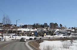
Småhusområde i Birkeland. | |
| Land | |
|---|---|
| Fylke | Agder fylke |
| Kommun | Birkenes kommun |
| Koordinater | 58°19′40″N 8°13′52″Ö / 58.32778°N 8.23111°Ö |
| Area | |
| - tätort | 2,05 km² |
| - kommun | 637,36 km² (2020) |
| Folkmängd | |
| - tätort | 2 934 (2019)[2] |
| - kommun | 5 390 (2023)[1] |
| Befolkningstäthet | |
| - tätort | 1 430 inv./km² |
| - kommun | 8 inv./km² |
| Tidszon | CET (UTC+1) |
| - sommartid | CEST (UTC+2) |
| Tätortskod | 3581 |
| Geonames | 3161532 |
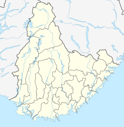
(c) Karte: NordNordWest, Lizenz: Creative Commons by-sa-3.0 de Ortens läge i Agder fylke | |
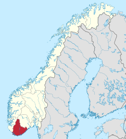
(c) Karte: NordNordWest, Lizenz: Creative Commons by-sa-3.0 de Agder fylke i Norge | |
| Wikimedia Commons: Birkeland (Birkenes) | |
Redigera Wikidata | |
Birkeland är en tätort som utgör centralort i Birkenes kommun i Agder fylke i södra Norge. Tätorten hade 2 426 invånare den 1 januari 2009.
Källor
- Den här artikeln är helt eller delvis baserad på material från norska Wikipedia (bokmål/riksmål), tidigare version.
- ^ 07459: Alders- og kjønnsfordeling i kommuner, fylker og hele landets befolkning (K) 1986 - 2023 (på norskt bokmål), Statistisk sentralbyrå, 21 februari 2023, läs online.[källa från Wikidata]
- ^ Tettsteders befolkning og areal (på norskt bokmål), Statistisk sentralbyrå, läs online.[källa från Wikidata]
Media som används på denna webbplats
Författare/Upphovsman: Gutten på Hemsen, Licens: CC0
Flag of Norway with colors from the previous version on Commons. This file is used to discuss the colors of the Norwegian flag.
Shiny red button/marker widget. Used to mark the location of something such as a tourist attraction.
(c) Karte: NordNordWest, Lizenz: Creative Commons by-sa-3.0 de
Location of county Agder in Norway (2024)
Författare/Upphovsman: Bjoertvedt, Licens: CC BY-SA 3.0
Image from the settlement Birkeland, center of the municipality of Birkenes, Aust-Agder county (Norway).
(c) Karte: NordNordWest, Lizenz: Creative Commons by-sa-3.0 de
Location map of Agder, Norway


