Beaufort
Beaufort kan avse:
- En skala för vindstyrka, se Beauforts skala
Geografi
Beaufort kan även syfta på följande platser:
Australien
- Beaufort (ort i Australien, South Australia), Wakefield, 34°05′00″S 138°12′00″Ö / 34.08333°S 138.2°Ö
- Beaufort, Victoria, Pyrenees, 37°25′48″S 143°23′00″Ö / 37.42996°S 143.38347°Ö
Frankrike
- Beaufort-sur-Gervanne, departementet Drôme i regionen Auvergne-Rhône-Alpes, 44°46′41″N 5°08′40″Ö / 44.77811°N 5.14434°Ö
- Beaufort-en-Vallée, departementet Maine-de-Loire i regionen Pays-de-la-Loire, 47°26′23″N 0°13′08″V / 47.43965°N 0.2189°V
- Beaufort-en-Santerre, departementet Somme i regionen Hauts-de-France, 49°46′34″N 2°40′05″Ö / 49.77611°N 2.66809°Ö
- Beaufort-en-Argonne, departementet Meuse i regionen Grand Est, 49°28′20″N 5°06′49″Ö / 49.47218°N 5.11356°Ö
- Beaufort-Blavincourt, Nord-Pas-de-Calais, Pas-de-Calais, 50°17′00″N 2°30′00″Ö / 50.283333°N 2.5°Ö
- Beaufort, Jura, 46°34′25″N 5°26′19″Ö / 46.57356°N 5.43873°Ö
- Beaufort, Savoie, 45°43′04″N 6°34′26″Ö / 45.71776°N 6.57391°Ö
- Beaufort, Isère, 45°19′45″N 5°07′37″Ö / 45.32925°N 5.12708°Ö
- Beaufort, Haute-Garonne, 43°27′33″N 1°06′42″Ö / 43.45929°N 1.11167°Ö
- Beaufort, Hérault, 43°17′49″N 2°45′22″Ö / 43.29689°N 2.75607°Ö
- Beaufort, Nord, 50°12′54″N 3°57′52″Ö / 50.215°N 3.96444°Ö
Libanon
- Beaufort, Libanon, fornlämning, Nabatiye, 33°19′27″N 35°31′55″Ö / 33.32417°N 35.53194°Ö
Luxemburg
- Beaufort, Luxemburg, huvudort i kommunen Beaufort, 49°50′09″N 6°17′30″Ö / 49.83583°N 6.29167°Ö
- Beaufort, Luxemburg (kommun), kommun i kantonen Echternach
Malaysia
- Beaufort, Malaysia(en), stad i Sabah, 5°20′50″N 115°44′44″Ö / 5.3473°N 115.7455°Ö
Schweiz
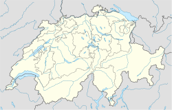
- Beaufort, Schweiz, bergstopp, Valais, 45°56′45″N 7°14′55″Ö / 45.94576°N 7.2485°Ö
Storbritannien
- Beaufort, Blaenau Gwent, community i Wales, 51°48′00″N 3°13′12″V / 51.79999°N 3.2199°V
Sydafrika
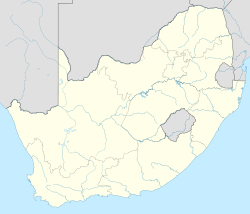
- Beaufort West(en), stad, Västra Kapprovinsen, Centrala Karoodistriktet, 32°21′00″S 22°35′00″Ö / 32.35°S 22.5833°Ö
- Fort Beaufort, stad, Östra Kapprovinsen, Amatoledistriktet, 32°47′00″S 26°38′00″Ö / 32.7833°S 26.6333°Ö
- Port Beaufort(en), ort, Västra Kapprovinsen, Eden, 34°23′45″S 20°49′25″Ö / 34.3958°S 20.823611°Ö
USA
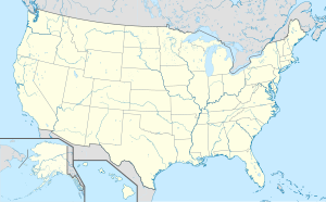
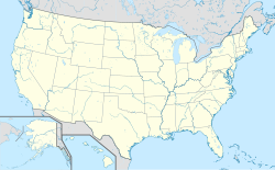
- Beaufort, North Carolina, countyhuvudort, Carteret County, 34°43′06″N 76°39′50″V / 34.71822°N 76.66382°V
- Beaufort, South Carolina, countyhuvudort, Beaufort County, 32°25′54″N 80°40′11″V / 32.43158°N 80.66983°V
- Beaufort County Airport, South Carolina, 32°24′44″N 80°38′04″V / 32.412222°N 80.634444°V
Personer
- Francis Beaufort (1774–1857), brittisk konteramiral, Beaufortskalans skapare
- Edmund Beaufort, 2:e hertig av Somerset (1406–1455)
- Edmund Beaufort, 4:e hertig av Somerset (ca 1438–1471)
- Francis Beaufort (1774–1857)
- Henrik Beaufort (1374–1447)
- Henrik Beaufort, hertig av Somerset (1436–1464)
- Johanna Beaufort (1404–1445), drottning av Skottland
- John Beaufort, 1:e earl av Somerset (1373–1410)
- Margaret Beaufort (1443–1509)
- Pierre Roger de Beaufort (1331–1378), påve, se Gregorius XI
- Thomas Beaufort (1377–1426)
- Carel Godin de Beaufort (1934–1964), nederländsk formel 1-förare
Övrigt
- Beaufort, en fransk ost
- Bristol Beaufort, ett brittiskt torpedflygplan (1938-1944)
| Det här är en förgreningssida som listar artiklar associerade med titeln Beaufort. Om du kom hit via en wikilänk, får du gärna ändra länken så att den hänvisar direkt till den avsedda sidan. |
Media som används på denna webbplats
Shiny blue button/marker widget.
Författare/Upphovsman: TUBS
Location map of the USA (Hawaii and Alaska shown in sidemaps).
Main map: EquiDistantConicProjection : Central parallel :
* N: 37.0° N
Central meridian :
* E: 96.0° W
Standard parallels:
* 1: 32.0° N
* 2: 42.0° N
Made with Natural Earth. Free vector and raster map data @ naturalearthdata.com.
Formulas for x and y:
x = 50.0 + 124.03149777329222 * ((1.9694462586094064-({{{2}}}* pi / 180))
      * sin(0.6010514667026994 * ({{{3}}} + 96) * pi / 180))
y = 50.0 + 1.6155950752393982 * 124.03149777329222 * 0.02613325650382181
      - 1.6155950752393982  * 124.03149777329222 *
     (1.3236744353715044  - (1.9694462586094064-({{{2}}}* pi / 180))
      * cos(0.6010514667026994 * ({{{3}}} + 96) * pi / 180))
Hawaii side map: Equirectangular projection, N/S stretching 107 %. Geographic limits of the map:
- N: 22.4° N
- S: 18.7° N
- W: 160.7° W
- E: 154.6° W
Alaska side map: Equirectangular projection, N/S stretching 210.0 %. Geographic limits of the map:
- N: 72.0° N
- S: 51.0° N
- W: 172.0° E
- E: 129.0° W
(c) Baumst, CC BY-SA 3.0
Disambiguation icon – gray scale version (author: Stephan Baum).
Författare/Upphovsman: Superbenjamin, Licens: CC BY-SA 4.0
Blank administrative map of France for geo-location purpose, with regions and departements distinguished. Approximate scale : 1:3,000,000
Författare/Upphovsman: NordNordWest, Licens: CC BY 3.0
Location map of South Africa
Författare/Upphovsman:
- Luxembourg adm location map.svg: NordNordWest
- derivative work: Jann
Location map of Luxembourg
Författare/Upphovsman: Uwe Dedering, Licens: CC BY-SA 3.0
Location map of Malaysia.
Equirectangular projection. Strechted by 100.0%. Geographic limits of the map:
* N: 8.0° N
* S: 0.0° N
* W: 99.0° E
* E: 120.0° E
Made with Natural Earth. Free vector and raster map data @ naturalearthdata.com.
(c) Karte: NordNordWest, Lizenz: Creative Commons by-sa-3.0 de
Location map of Lebanon
Författare/Upphovsman: NordNordWest, Licens: CC BY-SA 3.0
Location map of Australia
(c) Karte: NordNordWest, Lizenz: Creative Commons by-sa-3.0 de
Location map of the United Kingdom
Författare/Upphovsman: NordNordWest, Licens: CC BY-SA 3.0
Location map of Switzerland
