Banda
Banda kan syfta på:
- Banda (folk) – ett folkslag i Centralafrikanska republiken
- Banda (musikgenre) – en mexikansk musikstil
Geografi
Argentina
Banda i Argentina. |
- Departamento de Banda, kommun, Santiago del Estero, 27°30′00″S 64°20′00″V / 27.5°S 64.33333°V
Indien
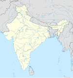
Banda i Indien. |
- Banda (stad), ort, Uttar Pradesh, Bānda, 25°28′39″N 80°20′06″Ö / 25.47758°N 80.33491°Ö
- Banda (ort i Indien, Madhya Pradesh), Sāgar, 24°02′42″N 78°57′39″Ö / 24.04488°N 78.96094°Ö
- Bānda (distrikt i Indien), Uttar Pradesh, 25°30′N 80°30′Ö / 25.5°N 80.5°Ö
Indonesien
- Bandaöarna – en ögrupp i provinsen Maluku
Kina
- Banda, Jiangxi, socken i provinsen Jiangxi
Mexiko
Banda i Mexiko. |
- Banda (ort i Mexiko), ort, Guanajuato, San Miguel de Allende, 20°57′50″N 100°49′15″V / 20.9639°N 100.82082°V
Media som används på denna webbplats
Shiny blue button/marker widget.
(c) Uwe Dedering på tyska Wikipedia, CC BY-SA 3.0
Location map of India.
Equirectangular projection. Strechted by 106.0%. Geographic limits of the map:
- N: 37.5° N
- S: 5.0° N
- W: 67.0° E
- E: 99.0° E
Författare/Upphovsman: Sémhur, Licens: CC BY-SA 4.0
Map of Mexico, with states borders.
Logo for disambiguation pages.
Författare/Upphovsman: NordNordWest, Licens: CC BY-SA 3.0
Location map of Argentina


