Ballasalla
| Ballasalla | |
| Ort | |
(c) Andy Stephenson, CC BY-SA 2.0 Ballasalla. | |
| Territorium | |
|---|---|
| Koordinater | 54°05′52″N 4°37′54″V / 54.09778°N 4.63167°V |
| Tidszon | UTC (UTC+0) |
| - sommartid | BST (UTC+1) |
| Geonames | 3042264 |
Läge i Isle of Man | |
Ballasalla (Manx: Balley Salley) är en mindre stad nära Castletown på Isle of Man. Den är till största delen byggt av sten från Rushen Abby som ligger en liten bit därifrån. Ballasalla ligger i närheten av Isle of Mans flygplats och den har också en station där Isle of Mans Steam Railway stannar till.
Varje sommar hålls här en keltisk festival med musik och dans. Det manxiska namnet Balley Salley betyder platsen med pilträd.
Se även
Källor
Fritt översatt ifrån engelska Wikipedia.
Media som används på denna webbplats
Författare/Upphovsman: Fry1989 eh?, Licens: CC0
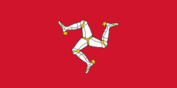
Flag of the Isle of Mann. This version has the triskelion centered as a whole rather than based upon the imaginary circle created by the prongs of each leg.
Shiny red button/marker widget. Used to mark the location of something such as a tourist attraction.
Författare/Upphovsman:
- IsleOfMan_SheadingsAndParishes-en.svg: Sémhur
- derivative work: Entlinkt (talk)
Location map of the Isle of Man, showing sheadings as well as local authorities (towns, villages, districts, parishes).
Geographic limits of the map:
- W: -4° 58' 0"
- E: -4° 7' 0"
- S: 54° 0' 0"
- N: 54° 27' 30"


