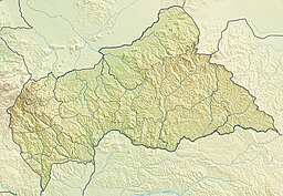
Bahr Aouk
| Bahr Aouk | |
| Bahr el Khisseï, Bahr Aukale, Bahr Kameui, Aoukalé, Bahr Auk, Bahr Bakare, Aouk | |
| Vattendrag | |
| Länder | |
|---|---|
| Koordinater | 8°50′46″N 18°52′41″Ö / 8.84614°N 18.87798°Ö |
| Tidszon | WAT (UTC+1) |
| Geonames | 2390625 |
Bahr Aouk är ett vattendrag på gränsen mellan Centralafrikanska republiken och Tchad, ett biflöde till Chari. En del av källorna är i Sudan.[1][2]
Källor
- ^ The Geographer (1962). ”Central African Republic – Sudan Boundary” (på engelska). International Boundary Study (Washington DC: Office of the Geographer, Bureau of Intelligence and Research) 16: sid. 3. http://library.law.fsu.edu/Digital-Collections/LimitsinSeas/pdf/ibs016.pdf. Läst 2 februari 2022.
- ^ The Geographer (1968). ”Central African Republic – Chad Boundary” (på engelska). International Boundary Study (Washington DC: Office of the Geographer, Bureau of Intelligence and Research) 83: sid. 5. http://library.law.fsu.edu/Digital-Collections/LimitsinSeas/pdf/ibs083.pdf. Läst 2 februari 2022.
Media som används på denna webbplats
Shiny red button/marker widget. Used to mark the location of something such as a tourist attraction.
Författare/Upphovsman: Carport, Licens: CC BY-SA 3.0
Physical location map of the Central African Republic


