Ashville, Ohio
| Ashville, Ohio | |
| By (village) | |
| Land | |
|---|---|
| Delstat | |
| County | Pickaway County |
| Höjdläge | 216 m ö.h. |
| Koordinater | 39°43′3″N 82°57′10″V / 39.71750°N 82.95278°V |
| Area | 6,49 km² (2010)[1] |
| Folkmängd | 4 529 (2020)[2] |
| Befolkningstäthet | 698 invånare/km² |
| Tidszon | EST (UTC-5) |
| - sommartid | EDT (UTC-4) |
| ZIP-kod | 43103 |
| GNIS-kod | 1064348 |
| Geonames | 4505522 |
Översiktskarta | |
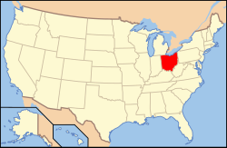
Ohios läge i USA | |
| Wikimedia Commons: Ashville, Ohio | |
| Webbplats: http://www.ashvilleohio.net/ | |
| Redigera Wikidata | |

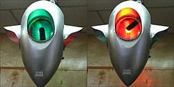
Ashville är en by i Pickaway County i den amerikanska delstaten Ohio med en yta av 4 km² och en folkmängd som uppgår till 3 174 invånare (2000). I byn finns ett historiskt museum, Ohio's Small Town Museum. Huvudattraktionen är USA:s äldsta trafikljus som numera finns till för fotgängartrafiken inom museets väggar men som 1982 togs ur bruk från hörnet av Main Street och Long Street.
Referenser
- ^ United States Census Bureau, 2010 U.S. Gazetteer Files, United States Census Bureau, 2010, läst: 9 juli 2020.[källa från Wikidata]
- ^ United States Census Bureau (red.), USA:s folkräkning 2020, läs online, läst: 1 januari 2022.[källa från Wikidata]
Externa länkar
Media som används på denna webbplats
Författare/Upphovsman: This version: uploader
Base versions this one is derived from: originally created by en:User:Wapcaplet, Licens: CC BY 2.0
Map of USA with Ohio highlighted
Författare/Upphovsman: Don O'Brien, Licens: CC BY 2.0
I saw the historic traffic light when my son and I visited the fascinating museum in Ashville, Ohio. For more that 50 years it controlled traffic at the town's main intersection. About 1981 it was replaced by a standard light to meet state regulations.
I remember driving through Ashville just to see the light back in the fifties.
Watching the light work at the museum, it reminded me of a weather radar screen. The green light pictured indicates it's about to turn red when the arm reaches the bottom.Författare/Upphovsman: Aesopposea, Licens: CC BY-SA 3.0
Looking west on Main Street.
Författare/Upphovsman: The original uploader was Catbar på engelska Wikipedia., Licens: CC BY-SA 3.0
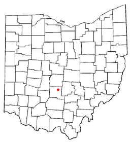
Map of Ashville.


