Ashton
Ashton kan syfta på,
- Ashton Gate Stadium ‒ fotbollsstadion i Bristol, England. Bristol City FC:s hemmaplan
- Familjen Ashton ‒ brittisk TV-serie
- Paice, Ashton and Lord ‒ brittiskt rockband
Geografi
Australien
- Ashton (ort i Australien), South Australia, Adelaide Hills, 34°56′22″S 138°44′13″Ö / 34.93949°S 138.73707°Ö
Kanada
- Ashton, Ontario, ort, 45°09′00″N 76°01′58″V / 45.15011°N 76.03267°V
Storbritannien
- Ashton-under-Lyne, stad och centralort i Borough of Tameside, England, 53°29′20″N 2°05′56″V / 53.48876°N 2.0989°V
- Ashton-in-Makerfield, ort i Borough of Wigan, England, 53°29′00″N 2°39′00″V / 53.48333°N 2.65°V
- Ashton, Devon, civil parish, England, 50°38′50″N 3°36′43″V / 50.64725°N 3.61195°V
- Ashton, East Northamptonshire, ort, England, 52°29′09″N 0°25′34″V / 52.48588°N 0.42621°V
- Ashton, South Northamptonshire, ort , England, 52°08′33″N 0°52′19″V / 52.14254°N 0.87192°V
- Ashton, Cambridgeshire, ort i Peterborough, Cambridgeshire, England, 52°37′52″N 0°22′09″V / 52.6310°N 0.3691°V
- Ashton Hayes, ort i Cheshire, England, 53°13′03″N 2°44′35″V / 53.2176°N 2.7431°V
- Ashton, Cornwall , ort i Cornwall, England, 50°06′12″N 5°21′28″V / 50.1034°N 5.3577°V
- Ashton, Hampshire, ort i Hampshire, England, 50°58′N 1°14′V / 50.96°N 1.23°V
- Ashton, Herefordshire, ort i Herefordshire, England, 52°16′34″N 2°42′39″V / 52.2761°N 2.71093°V
- Ashton, Somerset, by i Chapel Allerton, Somerset, England, 51°14′40″N 2°50′33″V / 51.2445°N 2.8425°V
- Ashton, Skottland, stadsdel i Gourock, Skottland, 55°57′15″N 4°49′54″V / 55.9541°N 4.8317°V (ej på kartan)
- Ashton upon Mersey, ort i Trafford, Greater Manchester, England
Sydafrika
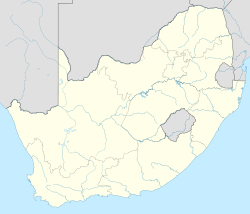
- Ashton, Sydafrika(en), ort i Västra Kapprovinsen, Cape Winelands District Municipality, 33°49′53″S 20°03′21″Ö / 33.83136°S 20.05595°Ö
USA
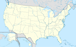
- Ashton, Iowa, ort i Osceola County, 43°18′41″N 95°47′28″V / 43.31136°N 95.79113°V
- Ashton, Illinois, ort i Lee County, 41°51′58″N 89°13′16″V / 41.86614°N 89.22121°V
- Ashton, Nebraska, ort i Sherman County, 41°14′53″N 98°47′39″V / 41.24807°N 98.79425°V
- Ashton, South Dakota, ort i Spink County, 44°59′42″N 98°29′52″V / 44.99497°N 98.49787°V
- Ashton, Idaho, ort i Fremont County, 44°04′18″N 111°26′54″V / 44.07158°N 111.44829°V
Personer
Efternamn
- Algernon Ashton, brittisk tonsättare, pianopedagog och essäist.
- Carter Ashton, kanadensisk ishockeyspelare.
- Catherine Ashton, brittisk politiker.
- Clark Ashton Smith, amerikansk författare, poet, skulptör och konstnär.
- Dean Ashton, engelsk fotbollsspelare.
- Frank Ashton-Gwatkin, brittisk diplomat och författare, känd som John Paris
- Frederick Ashton, brittisk balettdansare och koreograf.
- John Ashton, amerikansk skådespelare.
- Peter Shaw Ashton, brittisk botanist.
- Ruth Elizabeth Ashton, botanist.
- Tony Ashton, engelsk musiker.
Förnamn
- Ashton Carter, amerikansk forskare, USA:s försvarsminister.
- Ashton Eaton, amerikansk mångkampare.
- Ashton Kutcher, amerikansk skådespelare, programledare, fotomodell och producent.
Media som används på denna webbplats
Shiny blue button/marker widget.
Logo for disambiguation pages.
Författare/Upphovsman: NordNordWest, Licens: CC BY 3.0
Location map of South Africa
Författare/Upphovsman: NordNordWest, Licens: CC BY-SA 3.0
Location map of Ontario, Canada
Författare/Upphovsman: TUBS
Location map of the USA (Hawaii and Alaska shown in sidemaps).
Main map: EquiDistantConicProjection : Central parallel :
* N: 37.0° N
Central meridian :
* E: 96.0° W
Standard parallels:
* 1: 32.0° N
* 2: 42.0° N
Made with Natural Earth. Free vector and raster map data @ naturalearthdata.com.
Formulas for x and y:
x = 50.0 + 124.03149777329222 * ((1.9694462586094064-({{{2}}}* pi / 180))
      * sin(0.6010514667026994 * ({{{3}}} + 96) * pi / 180))
y = 50.0 + 1.6155950752393982 * 124.03149777329222 * 0.02613325650382181
      - 1.6155950752393982  * 124.03149777329222 *
     (1.3236744353715044  - (1.9694462586094064-({{{2}}}* pi / 180))
      * cos(0.6010514667026994 * ({{{3}}} + 96) * pi / 180))
Hawaii side map: Equirectangular projection, N/S stretching 107 %. Geographic limits of the map:
- N: 22.4° N
- S: 18.7° N
- W: 160.7° W
- E: 154.6° W
Alaska side map: Equirectangular projection, N/S stretching 210.0 %. Geographic limits of the map:
- N: 72.0° N
- S: 51.0° N
- W: 172.0° E
- E: 129.0° W
(c) Karte: NordNordWest, Lizenz: Creative Commons by-sa-3.0 de
Location map of Northern Ireland, United Kingdom
Författare/Upphovsman: NordNordWest, Licens: CC BY-SA 3.0
Location map of Australia


