Arve
| Arve | |
| L'Arve Rivière, Arve Rivière, L'Arve Torrent | |
| Vattendrag | |
This file is not in the public domain. Therefore you are requested to use the following next to the image if you reuse this file: © Yann Forget / Wikimedia Commons, CC BY-SA 3.0 | |
| Land | |
|---|---|
| Koordinater | 46°11′54″N 6°07′50″Ö / 46.19827°N 6.13061°Ö |
| Tidszon | CET (UTC+1) |
| - sommartid | CEST (UTC+2) |
| Geonames | 2661706 |
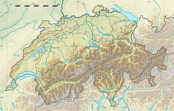
Arve är en 108 km lång vänsterbiflod till Rhône[1] som de första nio kilometrarna rinner genom sydvästra Schweiz (kantonen Genève) och fortsätter sedan till Rhône genom departementet Haute-Savoie i östra Frankrike.[2]
Runt Arve är det i huvudsak tätbebyggt.[3]
Källor
- ^ Arve på Sandre - Eaufrance.
- ^ Arve hos GeoNames.Org (cc-by); post uppdaterad 2012-02-13; databasdump nerladdad 2016-01-03
- ^ ”NASA Earth Observations: Land Cover Classification”. NASA/MODIS. Arkiverad från originalet den 28 februari 2016. https://web.archive.org/web/20160228161657/http://neo.sci.gsfc.nasa.gov/view.php?datasetId=MCD12C1_T1. Läst 30 januari 2016.
Externa länkar
 Wikimedia Commons har media som rör Arve.
Media som används på denna webbplats
Författare/Upphovsman: Eric Gaba (Sting - fr:Sting) and NordNordWest, Licens: CC BY-SA 3.0
Blank physical map of Switzerland, for geo-location purpose. More maps: → Maps of Switzerland.
Shiny red button/marker widget. Used to mark the location of something such as a tourist attraction.
This file is not in the public domain. Therefore you are requested to use the following next to the image if you reuse this file: © Yann Forget / Wikimedia Commons, CC BY-SA 3.0
The Arve river in Annemasse, Haute-Savoie, France.


