Arta
Arta, Árta eller Artà kan syfta på:
- Arta (namn) ‒ ett kvinnonamn samt personer med namnet
- Arta (djur) ‒ ett släkte av fjärilar
Geografi
Azerbajdzjan
Djibouti
- Arta (region), 11°30′N 42°45′Ö / 11.5°N 42.75°Ö
- Arta, Djibouti, regionhuvudort, 11°31′20″N 42°50′31″Ö / 11.52222°N 42.84194°Ö
Grekland
- Nomós Ártas, prefektur, Epirus, 39°10′00″N 21°00′00″Ö / 39.16667°N 21°Ö
- Arta (stad), en kommun i Grekland 39°09′00″N 20°59′00″Ö / 39.15°N 20.983333°Ö
- Árachthos Potamós, vattendrag, 39°00′45″N 21°04′01″Ö / 39.01253°N 21.06681°Ö
- Artabukten – en bukt i Joniska havet
Italien
- Arta Terme, kommun, Friuli-Venezia Giulia, Provincia di Udine, 46°28′54″N 13°01′16″Ö / 46.48173°N 13.02112°Ö
Spanien
- Artà (kommun), Balearerna, Illes Balears, 39°41′31″N 3°20′57″Ö / 39.69196°N 3.34907°Ö
- Artà (kommunhuvudort), Balearerna, Illes Balears, 39°41′35″N 3°20′59″Ö / 39.69315°N 3.34979°Ö
Media som används på denna webbplats
Shiny blue button/marker widget.
Författare/Upphovsman: Roi González Villa (Vivaelcelta), Licens: CC BY-SA 3.0
Location map of Spain
Equirectangular projection, N/S stretching 130 %. Geographic limits of the map:
- N: 44.4° N
- S: 34.7° N
- W: 9.9° W
- E: 4.8° E
Logo for disambiguation pages.
(c) Karte: NordNordWest, Lizenz: Creative Commons by-sa-3.0 de
Location map of Azerbaijan
Författare/Upphovsman: NordNordWest, Licens: CC BY-SA 3.0
Location map of Djibouti
Författare/Upphovsman: NordNordWest, Licens: CC BY-SA 3.0
Location map of Italy (Commons photos) → en-Wikipedia Italy.
(c) Lencer, CC BY-SA 3.0
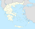
Location map of Greece
Equirectangular projection, N/S stretching 120 %. Geographic limits of the map:
- N: 42.0° N
- S: 34.6° N
- W: 19.1° E
- E: 29.9° E


