Archangaj
| Archangaj (Архангай Аймаг) | |||
| Provins | |||
| |||
| Land | |||
|---|---|---|---|
| Koordinater | 48°00′N 101°30′Ö / 48.0°N 101.5°Ö | ||
| Tsetserleg | |||
| Tidszon | MST (UTC+8) | ||
| ISO 3166-2-kod | MN-073- | ||
| Geonames | 2032855 | ||
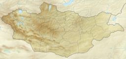
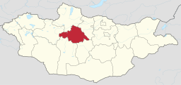
Läge i Mongoliet | |||
Lägeskarta | |||
Archangaj (uttal: [arxaŋɢaj]; Архангай аймаг med mongolisk kyrillisk skrift) är en provins (ajmag) i centrala Mongoliet. Den har totalt 97 091 invånare (2000) och en areal på 55 300 km². Provinsens huvudstad är Tsetserleg.
Administrativ indelning
Provinsen är indelad i 19 distrikt (sum): Bat-tsengel, Bulgan, Erdenemandal, Ich-Tamir, Jargalant, Khayrkhan, Khangay, Khashaat, Khotont, Tariat, Tjuluut, Tsakhir, Tsenkher, Tsetserleg, Ögiy nuur, Ölzijt och Öndör-Ulaan.
Externa länkar
 Wikimedia Commons har media som rör Archangaj.
| |||||||||||||
Media som används på denna webbplats
Shiny red button/marker widget. Used to mark the location of something such as a tourist attraction.
Författare/Upphovsman:
- File:Mongolia location map.svg: NordNordWest
- derivative work Виктор_В
Relief map of Mongolia
Flag of Arkhangai Aimag in Mongolia.
It starts to appear on photographs in 2014, so it was probably introduced that year.
There are also instances with the COA in the center of the flag.Författare/Upphovsman: TUBS
Location of aimag xy (see filename) in Mongolia.
Coat of Arms of Arkhangai Aimag in Mongolia.
It starts to appear on photographs in 2014, so it was probably introduced that year.
No official blason found.
- Taikhar Chuluu (pituresqe rock)
- Khorgo (extinct volcano)
- A Yak
- A monastery building
- A body of water
- In the water(?), a deer reminiscent of those found on prehistoric stone carvings, with its antlers forming the distorted numerals "1923".
- Green leaves
- The name "Arkhangai" in cyrillic letters
- A circular frame with crossing meanders
- Based on a lotos
- A three-tongued flame on top
Författare/Upphovsman: User:Doron, Licens: CC BY-SA 3.0
Landscape of Tariat, Arkhangai Province, Mongolia.


