Albion (olika betydelser)
Albion kan avse:
- Albion – det tidigast kända namnet på Storbritannien
- Albion (datorspel) – ett datorrollspel
- Albion (Fable) – ett fiktivt land i TV-spelet Fable
- Albion (tecknad serie) – en tecknad serie.
- Albion Motors – ett brittiskt bilmärke som byggdes i Glasgow år 1899–1980
- Albion Rovers FC (Skottland) – skotskt fotbollslag
- Albion Rovers FC (Wales) – walesiskt fotbollslag
- Brighton & Hove Albion FC – engelskt fotbollslag
- West Bromwich Albion FC – engelskt fotbollslag
- 15760 Albion – en asteroid
- Albion-Polka en polka av Johann Strauss den yngre
Geografi
Antarktis
- Mount Albion, 70°17′15″S 65°38′25″Ö / 70.2875°S 65.64028°Ö
Australien
- Albion, Victoria, Brimbank, 37°46′00″S 144°50′00″Ö / 37.76667°S 144.83333°Ö
Mauritius
- Albion (ort i Mauritius), Black River, 20°12′42″S 57°24′03″Ö / 20.21167°S 57.40083°Ö
USA
- Albion, Illinois, countyhuvudort, Edwards County, 38°22′39″N 88°03′22″V / 38.37755°N 88.05615°V
- Albion (flygplats), New Jersey, Camden County, 39°46′45″N 74°57′04″V / 39.77928°N 74.951°V
- Albion, Oklahoma, Pushmataha County, 34°39′46″N 95°06′00″V / 34.66288°N 95.09996°V
- Albion, Iowa, Marshall County, 42°06′45″N 92°59′19″V / 42.11249°N 92.98853°V
- Albion, Indiana, countyhuvudort, Noble County, 41°23′44″N 85°25′28″V / 41.3956°N 85.42442°V
- Albion, Maine, Kennebec County, 44°31′56″N 69°26′33″V / 44.53229°N 69.44254°V
- Albion, Michigan, ort, Calhoun County, 42°14′35″N 84°45′11″V / 42.2431°N 84.75303°V
- Albion, Nebraska, countyhuvudort, Boone County, 41°41′27″N 98°00′13″V / 41.69084°N 98.00367°V
- Albion, New York, countyhuvudort, Orleans County, 43°14′47″N 78°11′37″V / 43.24645°N 78.19363°V
- Albion (stad i Orleans County, New York), stad (town) i Orleans County
- Albion (stad i Oswego County, New York), stad (town) i Oswego County
- Albion, Pennsylvania, Erie County, 41°53′26″N 80°21′59″V / 41.89061°N 80.36645°V
- Albion, Pennsylvania, Jefferson County, 40°57′32″N 78°56′49″V / 40.95895°N 78.94698°V
- Albion, Kalifornien, Mendocino County, 39°13′25″N 123°46′07″V / 39.22351°N 123.76863°V
- Albion, Idaho, Cassia County, 42°24′46″N 113°34′41″V / 42.41269°N 113.57806°V
- Albion, Washington, Whitman County, 46°47′28″N 117°15′02″V / 46.791°N 117.25045°V
Media som används på denna webbplats
Shiny blue button/marker widget.
Författare/Upphovsman: NordNordWest, Licens: CC BY-SA 3.0
Location map of Australia
Författare/Upphovsman: TUBS
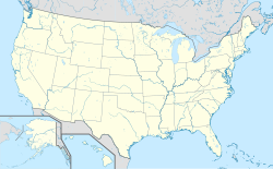
Location map of the USA (Hawaii and Alaska shown in sidemaps).
Main map: EquiDistantConicProjection : Central parallel :
* N: 37.0° N
Central meridian :
* E: 96.0° W
Standard parallels:
* 1: 32.0° N
* 2: 42.0° N
Made with Natural Earth. Free vector and raster map data @ naturalearthdata.com.
Formulas for x and y:
x = 50.0 + 124.03149777329222 * ((1.9694462586094064-({{{2}}}* pi / 180))
      * sin(0.6010514667026994 * ({{{3}}} + 96) * pi / 180))
y = 50.0 + 1.6155950752393982 * 124.03149777329222 * 0.02613325650382181
      - 1.6155950752393982  * 124.03149777329222 *
     (1.3236744353715044  - (1.9694462586094064-({{{2}}}* pi / 180))
      * cos(0.6010514667026994 * ({{{3}}} + 96) * pi / 180))
Hawaii side map: Equirectangular projection, N/S stretching 107 %. Geographic limits of the map:
- N: 22.4° N
- S: 18.7° N
- W: 160.7° W
- E: 154.6° W
Alaska side map: Equirectangular projection, N/S stretching 210.0 %. Geographic limits of the map:
- N: 72.0° N
- S: 51.0° N
- W: 172.0° E
- E: 129.0° W
Logo for disambiguation pages.
Författare/Upphovsman: Alexrk2, Licens: CC BY-SA 3.0
Location map Antarctica, Azimuthal equidistant projection
(c) Uwe Dedering på tyska Wikipedia, CC BY-SA 3.0
Location map of Mauritius
Equirectangular projection. Stretched by 106.0%. Geographic limits of the map:
- N: -19.7° N
- S: -20.6° N
- W: 57.21° E
- E: 57.91° E


