Albion, Indiana
| Albion | |
| town | |
Domstolsbyggnaden | |
| Land | |
|---|---|
| Delstat | Indiana |
| County | Noble County |
| Höjdläge | 291 m ö.h. |
| Koordinater | 41°23′44″N 85°25′58″V / 41.39556°N 85.43278°V |
| Yta | 4,9 km² (2010) |
| - land | 4,9 km² |
| - vatten | 0,0 km² |
| Folkmängd | 2 349 (2010) |
| Befolkningstäthet | 479 invånare/km² |
| Tidszon | EST (UTC-5) |
| - sommartid | EDT (UTC-4) |
| ZIP-kod | 46701 |
| Riktnummer | 260 |
| FIPS | 1800820 |
| Geonames | 4917523 |
Ortens läge i Indiana | |
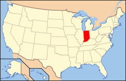
Indianas läge i USA | |
| Webbplats: albion-in.org | |
Albion är administrativ huvudort i Noble County i Indiana.[1][2][3] Vid 2010 års folkräkning hade Albion 2 349 invånare.[4]
Källor
- ^ Indiana County Map with County Seat Cities. Geology.com Geoscience News and Information. Läst 14 augusti 2017.
- ^ Albion, IN. Map Quest. Läst 14 augusti 2017.
- ^ Profile for Albion, Indiana Arkiverad 16 juni 2017 hämtat från the Wayback Machine.. ePodunk. Läst 14 augusti 2017.
- ^ 2010 Census Population of Albion, Indiana Arkiverad 14 augusti 2017 hämtat från the Wayback Machine.. Census Viewer. Läst 14 augusti 2017.
|
Media som används på denna webbplats
Shiny red button/marker widget. Used to mark the location of something such as a tourist attraction.
Noble County courthouse in Albion, Indiana.
The plaque in front reads:
:NOBLE COUNTY SEAT
:Noble County formed by General
:Assembly 1836; named after James
:Noble, first U.S. Senator from Indiana.
:County seats Sparta 1836, Augusta
:1837, Port Mitchell 1844. Center, later
:named Albion, selected 1846 as county
:seat in runoff election. Arrival of
:railroad in 1874 brought prosperity
:and major construction on courthouse
:square circa 1880-1890.
The cornerstone reads:
:LAID BY THE
:PIONEERS OF NOBLE COUNTY
:MAY 29, 1888.
Författare/Upphovsman: This version: uploader
Base versions this one is derived from: originally created by en:User:Wapcaplet, Licens: CC BY 2.0
Map of USA with Indiana highlighted
Författare/Upphovsman: Alexrk2, Licens: CC BY 3.0
Den här Det karta skapades med GeoTools.


