Alaverdi
| Alaverdi (Ալավերդի) | |
| Allaverdy | |
| Ort | |
Metallurgisk industri i Alaverdi | |
| Land | |
|---|---|
| Provins | Lorri |
| Koordinater | 41°7′34″N 44°39′28″Ö / 41.12611°N 44.65778°Ö |
| Tidszon | AMT (UTC+4) |
| Geonames | 616974 |
Alaverdi (armeniska: Ալավերդի, äldre Manes) är en stad vid floden Debed i provinsen Lori i norra Armenien, nära gränsen till Georgien. Befolkningen var 16 600 invånare i början av 2008.[1] Staden har betydande gruvdrift och ligger vid den enda järnvägsförbindelsen mellan Armenien och Georgien.
Vänorter
 Kobuleti, Georgien, sedan 28 maj 2007.[2]
 Agios Ioannis Rentis, (kommun i Aten), Grekland, sedan 1 oktober 2007.[3]
Källor
- ^ National Statistical Service of the Republic of Armenia; The Demographic Handbook of Armenia, 2008, part 2 (pdf-fil)
- ^ ”Sister cities”. Alaverdi town official website. Arkiverad från originalet den 1 augusti 2013. https://web.archive.org/web/20130801072034/http://www.alaverdi.am/index.php?option=com_content&view=article&id=1127&Itemid=437. Läst 24 augusti 2009.
- ^ ”Sister cities”. Alaverdi town official website. Arkiverad från originalet den 1 augusti 2013. https://web.archive.org/web/20130801064722/http://www.alaverdi.am/index.php?option=com_content&view=article&id=1128&Itemid=438. Läst 24 augusti 2009.
Media som används på denna webbplats
Shiny red button/marker widget. Used to mark the location of something such as a tourist attraction.
Författare/Upphovsman:
- File:Armenia location map.svg: NordNordWest
- derivative work Виктор_В
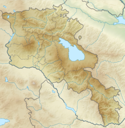
Relief map of Armenia.
Equirectangular projection, N/S stretching 130 %. Geographic limits of the map:
- N: 41.4° N
- S: 38.8° N
- W: 43.4° E
- E: 46.7° E
Alaverdi. Copper combine.


