Aioun Al Atrouss
| Aioun Al Atrouss | |
| Aïoun El Atrouss عيون العتروس | |
| Stad | |
Aioun Al Atrouss | |
| Land | |
|---|---|
| Region | Hodh El Gharbi |
| Departement | Aioun Al Atrouss |
| Höjdläge | 259 m ö.h. |
| Koordinater | 16°39′39″N 09°37′00″V / 16.66083°N 9.61667°V |
| Folkmängd | 22 796 (2013-03-25)[1] |
| Tidszon | GMT (UTC+0) |
| Geonames | 2381291 |
Stadens läge i Mauretanien | |
Aioun Al Atrouss, Aioûn el 'Atroûs, är en stad i regionen Hodh El Gharbi i södra Mauretanien. Staden hade 22 796 invånare (2013).[1] Den är huvudort för regionen Hodh El Gharbi.
Referenser
- ^ [a b] ”Mauritania: Regions, Cities & Urban Localites - Population Statistics in Maps and Charts” (på engelska). www.citypopulation.de. https://www.citypopulation.de/Mauritania-Cities.html. Läst 4 juli 2017.
Media som används på denna webbplats
Shiny red button/marker widget. Used to mark the location of something such as a tourist attraction.
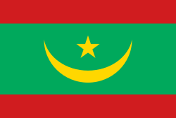
Flag of Mauritania, adopted in 2017. The National Assembly added red stripes to the top and bottom edges to represent “the blood shed by the martyrs of independence”.
Författare/Upphovsman: Eric Gaba (Sting - fr:Sting), Licens: CC BY-SA 3.0
Blank administrative map of Mauritania, for geo-location purposes.


