Adams
Adams kan syfta på:
Personer
- Adams (efternamn) – ett efternamn samt personer med namnet
- Adams (gatukonstnär) – en gatukonstnär från Stockholm
- Adams (auktor) – en auktorsförkortning för flera personer
Astronomi
- Adams (månkrater) – en nedslagskrater på månen
- Adams (krater) – en nedslagskrater på Mars
- 1996 Adams – en asteroid i huvudbältet
Geografi
Antarktis
- Adams Nunatak, 71°44′04″S 68°33′15″V / 71.73432°S 68.5541°V
- Cape Adams, Antarktis, 75°04′00″S 62°20′00″V / 75.06667°S 62.33333°V
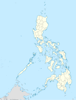
Filippinerna
- Adams (Norra Ilocos), en kommun i Ilocosregionen, Province of Ilocos Norte, 18°27′00″N 120°55′16″Ö / 18.4501°N 120.92122°Ö
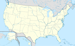
USA
- Adams, Tennessee, ort i Robertson County, 36°34′56″N 87°03′56″V / 36.58227°N 87.06556°V
- Adams, Massachusetts, ort i Berkshire County, 42°37′27″N 73°07′03″V / 42.62425°N 73.1176°V
- Adams, Minnesota, ort i Mower County, 43°33′55″N 92°43′10″V / 43.56524°N 92.71935°V
- Adams, North Dakota, ort i Walsh County, 48°25′17″N 98°04′44″V / 48.42139°N 98.07899°V
- Adams, Nebraska, ort i Gage County, 40°27′34″N 96°30′36″V / 40.45944°N 96.51002°V
- Adams, New York, ort i Jefferson County, 43°48′33″N 76°01′27″V / 43.80923°N 76.02409°V
- Adams, Wisconsin, ort i Adams County, 43°57′22″N 89°49′05″V / 43.95608°N 89.81818°V
- Adams, Oregon, ort i Umatilla County, 45°46′02″N 118°33′45″V / 45.76735°N 118.56247°V
Se även
- Adams County – flera olika amerikanska countyn
Se även
- Adam – flera betydelser
Media som används på denna webbplats
Shiny blue button/marker widget.
Författare/Upphovsman: TUBS
Location map of the USA (Hawaii and Alaska shown in sidemaps).
Main map: EquiDistantConicProjection : Central parallel :
* N: 37.0° N
Central meridian :
* E: 96.0° W
Standard parallels:
* 1: 32.0° N
* 2: 42.0° N
Made with Natural Earth. Free vector and raster map data @ naturalearthdata.com.
Formulas for x and y:
x = 50.0 + 124.03149777329222 * ((1.9694462586094064-({{{2}}}* pi / 180))
      * sin(0.6010514667026994 * ({{{3}}} + 96) * pi / 180))
y = 50.0 + 1.6155950752393982 * 124.03149777329222 * 0.02613325650382181
      - 1.6155950752393982  * 124.03149777329222 *
     (1.3236744353715044  - (1.9694462586094064-({{{2}}}* pi / 180))
      * cos(0.6010514667026994 * ({{{3}}} + 96) * pi / 180))
Hawaii side map: Equirectangular projection, N/S stretching 107 %. Geographic limits of the map:
- N: 22.4° N
- S: 18.7° N
- W: 160.7° W
- E: 154.6° W
Alaska side map: Equirectangular projection, N/S stretching 210.0 %. Geographic limits of the map:
- N: 72.0° N
- S: 51.0° N
- W: 172.0° E
- E: 129.0° W
Logo for disambiguation pages.
Författare/Upphovsman: Alexrk2, Licens: CC BY-SA 3.0
Location map Antarctica, Azimuthal equidistant projection
Författare/Upphovsman: NordNordWest, Licens: CC BY 3.0
Location map of the Philippines


