Adair, Iowa
| Adair | |
| Stad (city) | |
Vattentorn i Adair | |
| Uppkallad efter: John Adair | |
| Land | |
|---|---|
| Delstat | |
| Höjdläge | 291 m ö.h. |
| Koordinater | 41°30′0″N 94°38′38″V / 41.50000°N 94.64389°V |
| Area | 5,78 km² (2020)[1] |
| - land | 5,74 km² (2020) |
| - vatten | 0,04 km² (2020) |
| Folkmängd | 791 (2020)[2][3] |
| Befolkningstäthet | 138 invånare/km² |
| Grundad | 20 augusti 1872 |
| Tidszon | CST (UTC-6) |
| - sommartid | CDT (UTC-5) |
| ZIP-kod | 50002 |
| Riktnummer | 641 |
| GNIS-kod | 454088 |
| Geonames | 4846339 |
Adair i Adair County och Iowa | |
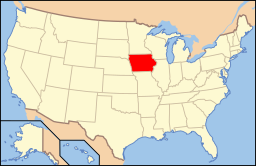
Iowas läge i USA | |
| Wikimedia Commons: Adair, Iowa | |
| Webbplats: https://www.cityofadair.com/ | |
| Redigera Wikidata | |
Adair är en ort (city) i Adair County och Guthrie County i delstaten Iowa i USA. Orten hade 791 invånare, på en yta av 5,78 km² (2020).[4][5]
Referenser
- ^ Gazetteer Files – 2020 (på engelska), United States Census Bureau, läs online, läst: 8 november 2021.[källa från Wikidata]
- ^ Explore Census Data – Adair city, Iowa (på engelska), United States Census Bureau, läs online, läst: 8 november 2021.[källa från Wikidata]
- ^ United States Census Bureau (red.), USA:s folkräkning 2020, läs online, läst: 1 januari 2022.[källa från Wikidata]
- ^ ”Explore Census Data – Adair city, Iowa” (på engelska). United States Census Bureau. https://data.census.gov/cedsci/profile?g=1600000US1900370. Läst 8 november 2021.
- ^ ”Gazetteer Files – 2020” (på engelska). United States Census Bureau. https://www.census.gov/geographies/reference-files/time-series/geo/gazetteer-files.2020.html. Läst 8 november 2021.
Externa länkar
 Wikimedia Commons har media som rör Adair.
- Officiell webbplats
Media som används på denna webbplats
Författare/Upphovsman: This version: uploader
Base versions this one is derived from: originally created by en:User:Wapcaplet, Licens: CC BY 2.0
Map of USA with Iowa highlighted
Författare/Upphovsman: Arkyan, Licens: CC BY-SA 3.0
This map shows the incorporated and unincorporated areas in Adair County, Iowa, highlighting Adair in red. It was created with a custom script with US Census Bureau data and modified with Inkscape.
(c) Billwhittaker på engelska Wikipedia, CC BY-SA 3.0
Water tower, Adair. Not my best photo, if someone has a better one of Adair, please replace. Sad to say that I took it from I-80. My apologies...


