Île-de-Bréhat
| Île-de-Bréhat | ||
| Kommun | ||
| ||
| Land | ||
|---|---|---|
| Region | ||
| Departement | ||
| Arrondissement | Saint-Brieuc | |
| Kanton | Paimpol | |
| Koordinater | 48°50′N 2°59′V / 48.833°N 2.983°V | |
| Yta | 3,09 km²[1] | |
| Folkmängd | 427 ()[2] | |
| Befolkningstäthet | 138 invånare/km² | |
| Tidszon | CET (UTC+1) | |
| - sommartid | CEST (UTC+2) | |
| Postnummer | 22870 | |
| INSEE | 22016 | |
| Geonames | 3030401 | |
| OSM-karta | 399669 | |
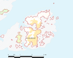
 Kommunens läge i regionen Bretagne i Frankrike | ||
| Webbplats: http://www.iledebrehat.fr | ||

Île-de-Bréhat är en kommun i departementet Côtes-d'Armor i regionen Bretagne i nordvästra Frankrike. Kommunen ligger i kantonen Paimpol som tillhör arrondissementet Saint-Brieuc. År 2022 hade Île-de-Bréhat 427 invånare.
Befolkningsutveckling
Antalet invånare i kommunen Île-de-Bréhat
Referens:INSEE[3]
Galleri
- Kapellet Keranroux.
- Kapellet Saint Michel.
- Moulin du Birlot (kvarn)
- Moulin du Birlot (kvarn)
- Moulin du Birlot (kvarn)
- Kapellet Keranroux.
Se även
Källor
- ^ Répertoire géographique des communes, Institut national de l'information géographique et forestière, läst: 26 oktober 2015.[källa från Wikidata]
- ^ Populations légales 2022, Institut National de la Statistique et des Études Économiques, 19 december 2024.[källa från Wikidata]
- ^ Chiffres clés - Évolution et structure de la population Arkiverad 5 juli 2012 hämtat från the Wayback Machine.
Media som används på denna webbplats
Författare/Upphovsman: Eric Gaba (Sting - fr:Sting), Licens: CC BY-SA 4.0
Blank physical map of metropolitan France for geo-location purpose.
Scale : 1:14 816 000 (accuracy : about 3,7 km) for the bathymetry. More maps of France, view → Commons Atlas of France.
Shiny red button/marker widget. Used to mark the location of something such as a tourist attraction.
Författare/Upphovsman: User:tuxthepenguin6, Licens: CC BY 2.5
The chapel Karenoux on Brehat
La cabaret des décapités doit son nom aux verres décorés des têtes des clients
Författare/Upphovsman: Original uploader was Calips at fr.wikipedia, Licens: CC BY-SA 1.0
Bretagne Ile de Bréhat Auteur : GIRAUD Patrick
Författare/Upphovsman: Benh LIEU SONG, Licens: CC BY-SA 3.0
La croix lighthouse, Bréhat island, Brittany, west France.
Författare/Upphovsman: [1], Licens: CC BY 2.0
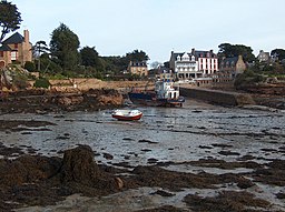
Port Clos harbour during low tide, Île-de-Bréhat, Brittany, France
Författare/Upphovsman: The original uploader was Calips på franska Wikipedia., Licens: CC BY-SA 1.0
Bretagne Ile de Bréhat Auteur : GIRAUD Patrick
Författare/Upphovsman: JLPC, Licens: CC BY-SA 3.0
Pink granite coast, North of Île de Bréhat, Côtes d'Armor, France.
Författare/Upphovsman: The original uploader was Calips på franska Wikipedia., Licens: CC BY-SA 1.0
Bretagne Ile de Bréhat Auteur : GIRAUD Patrick
Författare/Upphovsman:
|
Map data (c) OpenStreetMap contributors, CC-BY-SA  • Shape files infrastructure: railway, highways, water: all originally by OpenStreetMap contributors. Status december 2011 *note: shown commune boundaries are from OSM dump May 2012; at that time about 90% complete |
Map commune FR insee code 22016.png
Författare/Upphovsman: Edward Rice, Licens: CC BY 2.5
Looking over the island of Brehat from the hill on which the Chapelle St-Michelle stands
Författare/Upphovsman: Benh LIEU SONG, Licens: CC BY-SA 3.0
Bréhat island enclosed harbour (port clos) at high tide, Brittany, West France. This picture is a mosaic of 8 pictures (2x4) taken with a 1.6 crop body at 17mm (28mm equiv.), f/8.0, 1/320s and ISO 100. Stitching was done with Hugin and Enblend. Resulting horizontal FOV is about 200°.
Författare/Upphovsman:
| This photo was taken by Rüdiger Wölk. Please credit this photo Rüdiger Wölk, Münster. |
| View all photos (large page) of Rüdiger Wölk
I would also appreciate an email to rudiger.wolk@gmail.com with details of use. Für Hinweise auf Veröffentlichungen (rudiger.wolk@gmail.com) oder Belegexemplare bin ich Ihnen dankbar. |
Phare de la Croix - Ile de Bréhat
Författare/Upphovsman: The original uploader was Calips på franska Wikipedia., Licens: CC BY-SA 1.0
Bretagne Ile de Bréhat Auteur : GIRAUD Patrick


