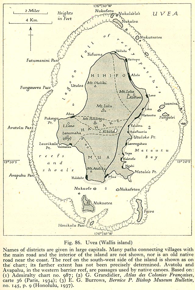
Uvea wallis island

Författare/Upphovsman:
Admiralty. Naval Intelligence Division.
Kreditera:
http://www.lib.utexas.edu/maps/historical/pacific_islands_1943_1945/uvea_wallis_island.jpg Geographical Handbook Series, Great Britain. Admiralty. Naval Intelligence Division, 1943-1945 - Volume III : Western Pacific (Tonga to Solomon Islands), 1944. Taken from the University of Texas Library.
Kort länk:
Källa:
Upplösning:
640 x 952 Pixel (188041 Bytes)
Beskrivning:
1944 Map of Wallis Island (ʻUvea)
Licens:
Public domain
Mer information om licensen för bilden finns här. Senaste uppdateringen: Tue, 03 Jan 2023 05:59:28 GMT