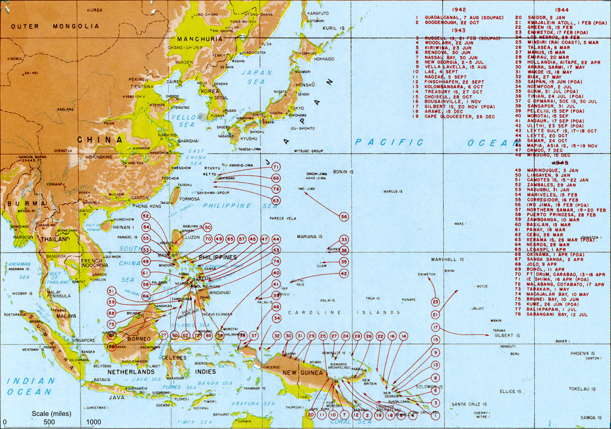
US landings
Författare/Upphovsman:
General MacArthur's General Staff
Kreditera:
MacArthur, Douglas (1994) [1950] Reports of General MacArthur, Vol. 1, Center of Military History, pp. p. 432. Archived from the original on 12 februari 2009. Retrieved on 24 februari 2009.
Kort länk:
Källa:
Upplösning:
1995 x 1401 Pixel (1162167 Bytes)
Beskrivning:
Map titled "Allied landings — August 1942 to August 1945", plate #126. It should be noted that while the title of the image is "US Landings" the map also indicates the position of many landings by Australian troops (at least) so should be referred to as "Allied landings".
Licens:
Public domain
Licenskommentaren:
This image is a work of a U.S. military or Department of Defense employee, taken or made as part of that person's official duties. As a work of the U.S. federal government, the image is in the public domain in the United States.
Mer information om licensen för bilden finns här. Senaste uppdateringen: Tue, 26 Dec 2023 06:25:21 GMT