Troyville and Baytown cultures map HRoe 2011
Författare/Upphovsman:
Kreditera:
Eget arbete
Kort länk:
Källa:
Upplösning:
600 x 494 Pixel (307383 Bytes)
Beskrivning:
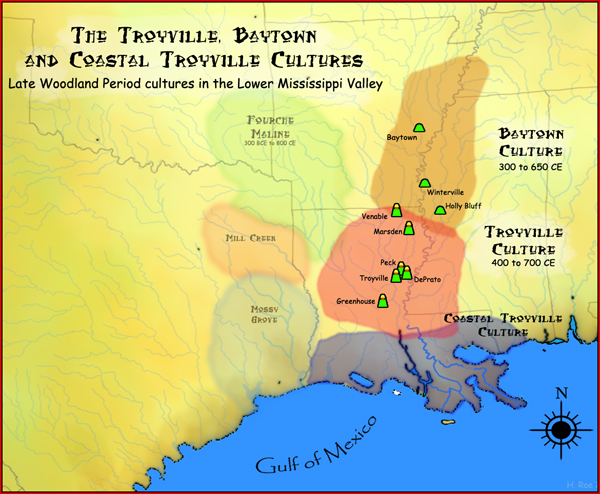
A map showing the geographical extent of the Troyville, Coastal Troyville and Baytown cultures during the Late Woodland period in the Southern United States, and some of its important sites.
Licens:
Licensvillkor:
Creative Commons Attribution-Share Alike 3.0
Mer information om licensen för bilden finns här. Senaste uppdateringen: Tue, 30 Jan 2024 13:29:59 GMT