Treasure-island-map
Författare/Upphovsman:
Kreditera:
- Original source: Beidecke Library
- Överförd från cs.wikipedia till Commons av Sevela.p med användning av CommonsHelper.
Kort länk:
Källa:
Upplösning:
2369 x 4211 Pixel (2326300 Bytes)
Beskrivning:
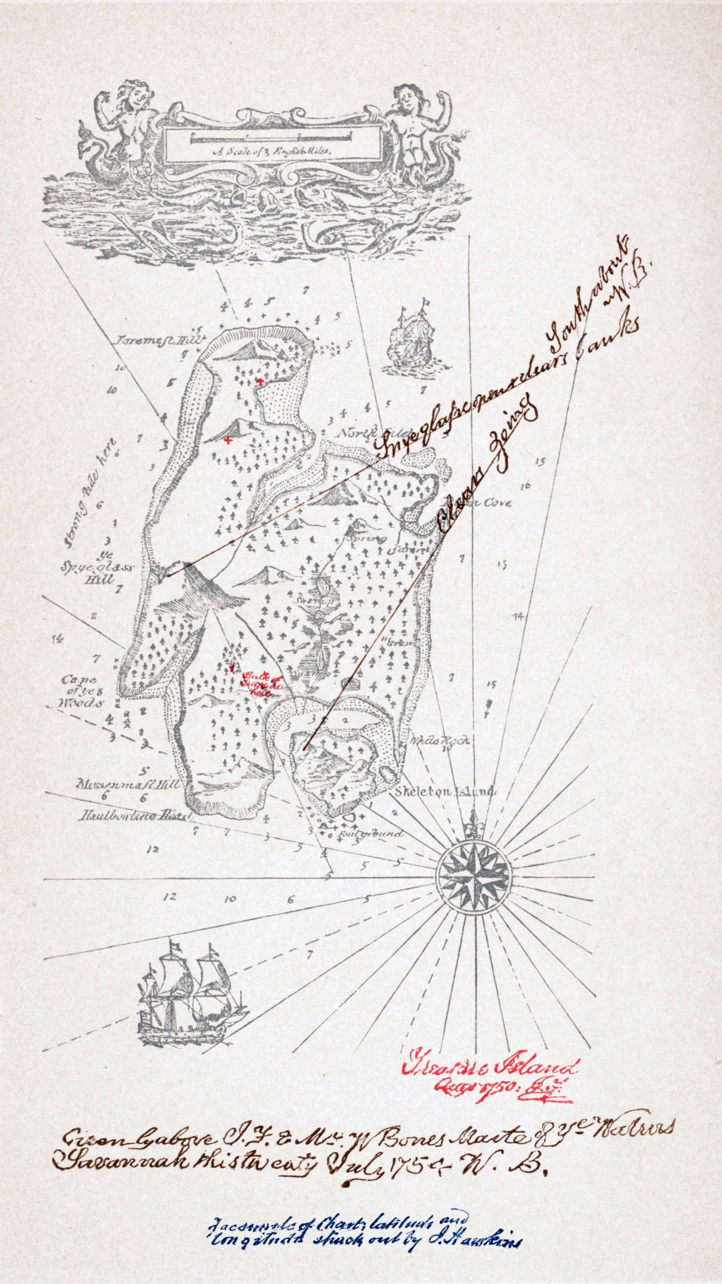
Map of Treasure Island from the 1883 edition by Cassel.
"I sent in my manuscript, and the map along with it, to Messrs. Cassell. The proofs came, they were corrected, but I heard nothing of the map. I wrote and asked; was told it had never been received, and sat aghast. It is one thing to draw a map at random, set a scale in one corner of it at a venture, and write up a story to the measurements. It is quite another to have to examine a whole book, make an inventory of all the allusions contained in it, and with a pair of compasses, painfully design a map to suit the data. I did it; and the map was drawn again in my father’s office, with embellishments of blowing whales and sailing ships, and my father himself brought into service a knack he had of various writing, and elaborately FORGED the signature of Captain Flint, and the sailing directions of Billy Bones. But somehow it was never Treasure Island to me." (Robert Louis Stevenson, My First Book: ‘Treasure Island’, First published in the Idler, August 1894 .
"I sent in my manuscript, and the map along with it, to Messrs. Cassell. The proofs came, they were corrected, but I heard nothing of the map. I wrote and asked; was told it had never been received, and sat aghast. It is one thing to draw a map at random, set a scale in one corner of it at a venture, and write up a story to the measurements. It is quite another to have to examine a whole book, make an inventory of all the allusions contained in it, and with a pair of compasses, painfully design a map to suit the data. I did it; and the map was drawn again in my father’s office, with embellishments of blowing whales and sailing ships, and my father himself brought into service a knack he had of various writing, and elaborately FORGED the signature of Captain Flint, and the sailing directions of Billy Bones. But somehow it was never Treasure Island to me." (Robert Louis Stevenson, My First Book: ‘Treasure Island’, First published in the Idler, August 1894 .
Licens:
Public domain
Licenskommentaren:
|
Detta verk är också upphovsrättsfritt i länder och områden där upphovsrätten förfaller 100 år eller färre efter upphovspersonens död. Detta verk är public domain i Förenta staterna eftersom det publicerades före den 1 januari 1930. | |
| Denna fil har identifierats som fri från kända begränsningar enligt upphovsrätten, inklusive alla relaterade och närliggande rättigheter. | |
Mer information om licensen för bilden finns här. Senaste uppdateringen: Fri, 31 Jan 2025 05:39:50 GMT