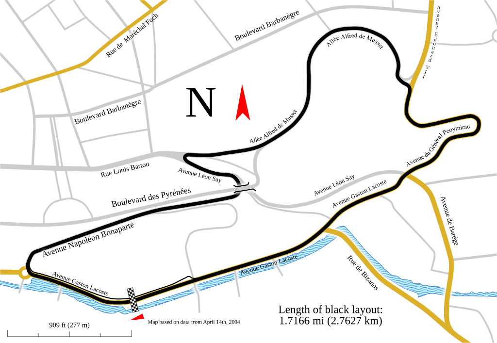
Track map for the Pau street circuit -- 2007
Författare/Upphovsman:
Tillskrivning:
Bilden är taggad "Attribution Required" men ingen tillskrivningsinformation lämnades. Attributionsparametern utelämnades troligen när MediaWiki-mallen användes för CC-BY-licenserna. Författare och upphovsmän hittar ett exempel för korrekt användning av mallarna här.
Kreditera:
Eget arbete
Kort länk:
Källa:
Upplösning:
1424 x 983 Pixel (193128 Bytes)
Beskrivning:
Track map for use with Pau Grand Prix. This version shows the track as it was in 2007.
Notes:
- This map has three text objects on paths. MediaWiki/RSVG has a bug causing it to hide all such objects. Hence, I the most recent version of this image should always have those objects converted into plain paths. If you need to edit the map, be sure to edit the previous version (compared to the current version). Then after making your changes:
- Upload it with the text objects on paths
- Convert each text object on a path back into a plain path
- Upload that version
- The text object labeled "Avenue Edouard VII" is actually a path. This is because Inkscape currently is unable to correctly put vertical text on paths. Converting it to a path let me use Inkscape's Bent Path LPE to shape the text to the road. In case the text of that object ever has to be edited, I backed it up in a hidden object at the same location.
Licens:
Licensvillkor:
Creative Commons Attribution-Share Alike 3.0
Mer information om licensen för bilden finns här. Senaste uppdateringen: Sun, 25 Aug 2024 20:55:50 GMT
