Tannenberg3008
Författare/Upphovsman:
US-Army under www.dean.usma.edu
Kreditera:
Taken from the campaign series, made public by the US-Army under dean.usma.edu
From website:
- In 1938 the predecessors of what is today The Department of History at the United States Military Academy began developing a series of campaign atlases to aid in teaching cadets a course entitled, "History of the Military Art." Since then, the Department has produced over six atlases and more than one thousand maps, encompassing not only America’s wars but global conflicts as well.
- In keeping abreast with today's technology, the Department of History is providing these maps on the internet as part of the department's outreach program. The maps were created by the United States Military Academy’s Department of History and are the digital versions from the atlases printed by the United States Defense Printing Agency. We gratefully acknowledge the accomplishments of the department's former cartographer, Mr. Edward J. Krasnoborski, along with the works of our present cartographer, Mr. Frank Martini.
- Please be aware that these maps are large in file size and may require substantial download times.
Kort länk:
Källa:
Upplösning:
1242 x 961 Pixel (212180 Bytes)
Beskrivning:
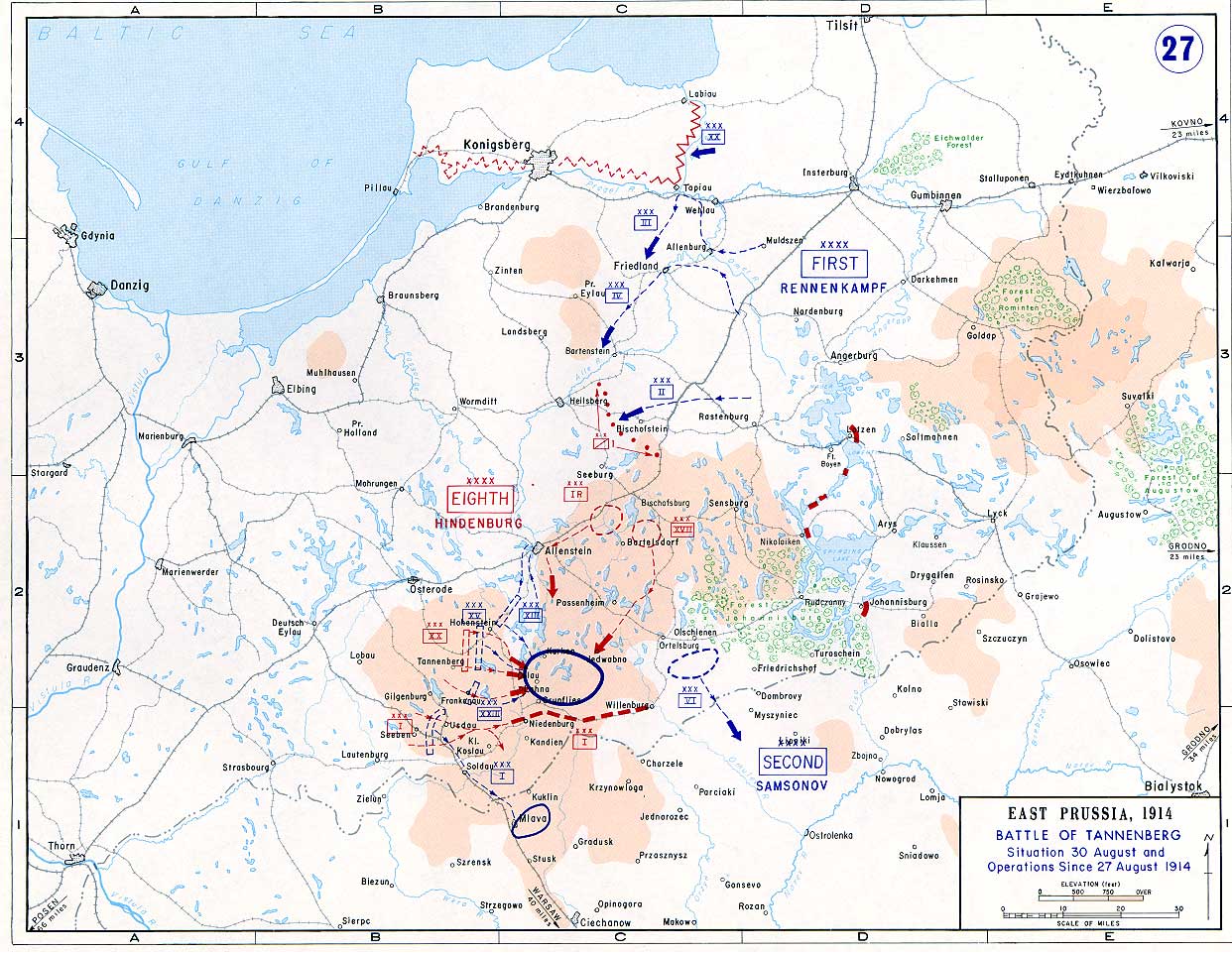
Battle of Tannenberg (1914) in its last phase
Licens:
Public domain
Licenskommentaren:
The picture is public domain.
Mer information om licensen för bilden finns här. Senaste uppdateringen: Wed, 11 Sep 2024 00:56:44 GMT