South asia
Författare/Upphovsman:
CIA
Kreditera:
CIA World Factbook
Kort länk:
Källa:
Upplösning:
425 x 533 Pixel (53008 Bytes)
Beskrivning:
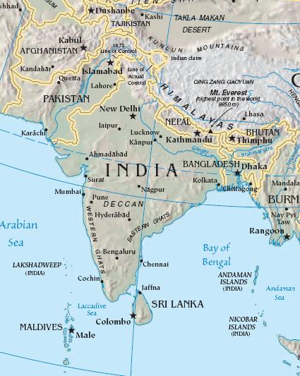
The image is cropped from en:Image:Sino-Indian Geography.png, created and published by the en:Central Intelligence Agency of the en:United States of America in en:2004.
Note
This map represents the en:line of control in en:Kashmir as the international border between the en:Republic of India and en:Islamic Republic of Pakistan, a position considered unacceptable to either party.
Licens:
Public domain
Mer information om licensen för bilden finns här. Senaste uppdateringen: Sun, 07 Jan 2024 16:27:08 GMT