Senkaku Diaoyu Tiaoyu Islands
Författare/Upphovsman:
Tillskrivning:
Bilden är taggad "Attribution Required" men ingen tillskrivningsinformation lämnades. Attributionsparametern utelämnades troligen när MediaWiki-mallen användes för CC-BY-licenserna. Författare och upphovsmän hittar ett exempel för korrekt användning av mallarna här.
Kreditera:
Kort länk:
Källa:
Upplösning:
900 x 900 Pixel (290587 Bytes)
Beskrivning:
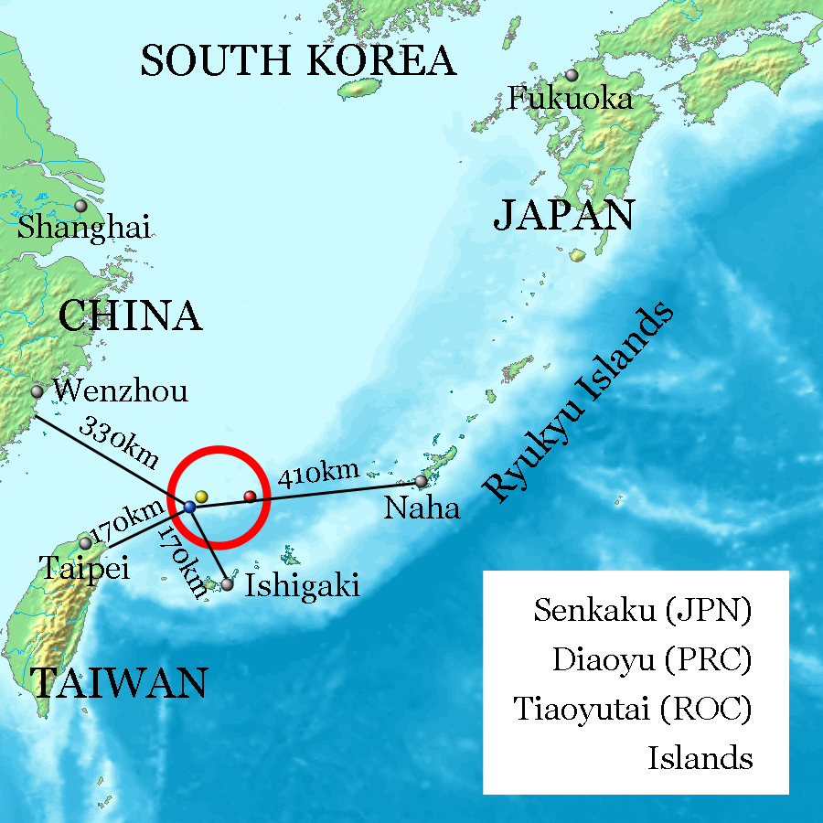
Uotsuri-shima / Diaoyu Dao (Blue, west end and nearly south end, 25°44′33″N 123°28′17″E at Mount Narahara), Kuba-shima / Huangwei Yu (Yellow, north end, 25°55′24″N 123°40′51″E at Mount Chitose), Taishō-tō / Chiwei Yu (Red, east end, 25°55′21″N 124°33′36″E at the peek) referenced on Geospatial Information Authority of Japan and distances referenced on Ministry of Foreign Affairs of Japan. Every distances of the map show coast to coast, but distances of the coast of Okinawa Island and Naha City, and the coast of Ishigaki-Island and Ishigaki City are quite near on the map.
Licens:
Licensvillkor:
Creative Commons Attribution-Share Alike 3.0
Mer information om licensen för bilden finns här. Senaste uppdateringen: Fri, 25 Apr 2025 22:36:05 GMT