Roman.Wales.Forts.Fortlets.Roads
Författare/Upphovsman:
my work
Tillskrivning:
Bilden är taggad "Attribution Required" men ingen tillskrivningsinformation lämnades. Attributionsparametern utelämnades troligen när MediaWiki-mallen användes för CC-BY-licenserna. Författare och upphovsmän hittar ett exempel för korrekt användning av mallarna här.
Kreditera:
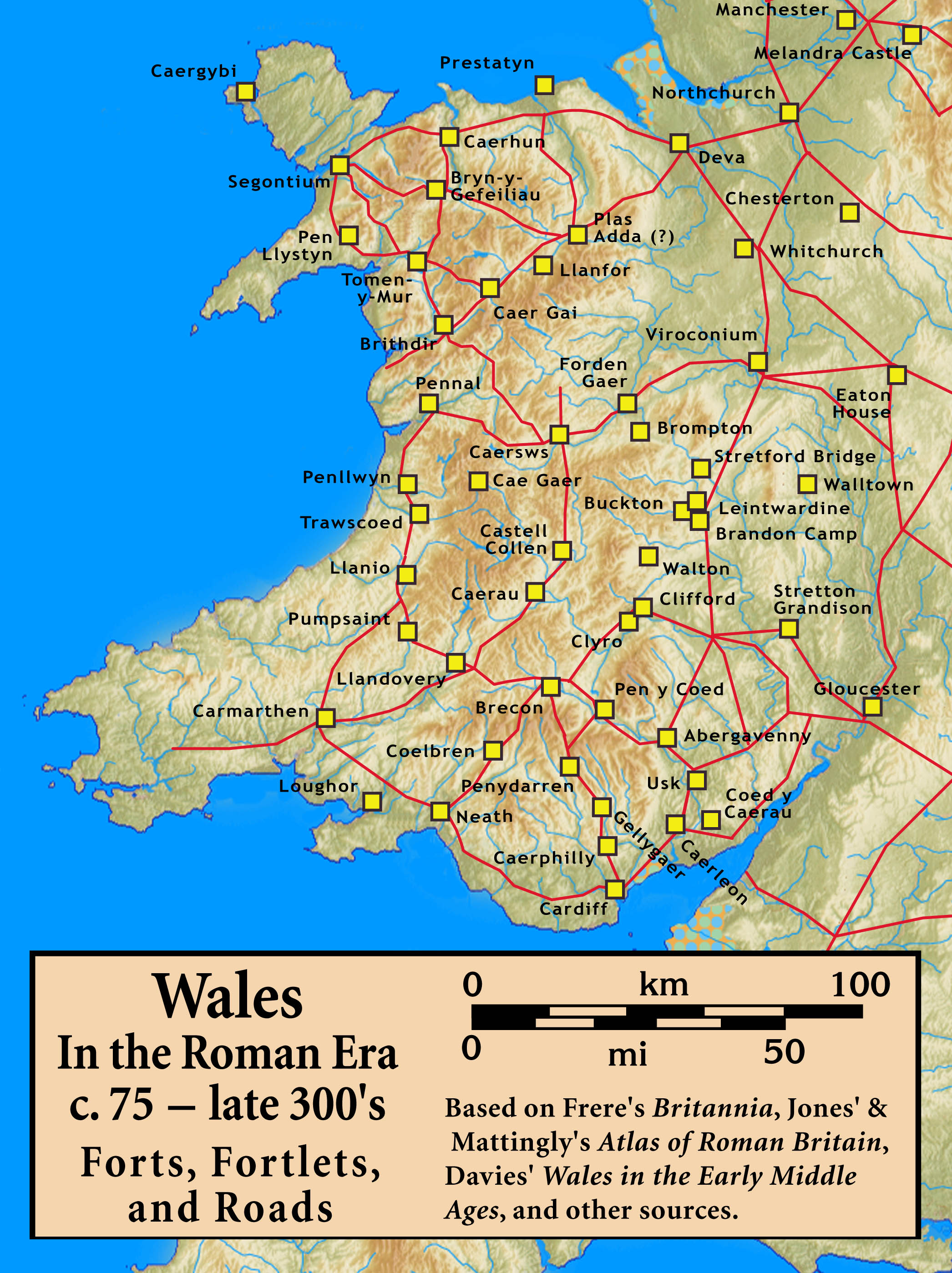
Based on Frere's Britannia, Jones' & Mattingly's Atlas of Roman Britain, Davies' Wales in the Early Middle Ages, the Antonine Itinerary, and other sources (roads are incomplete; forts were built/abandoned over time) — sources are cited in the image legend
Kort länk:
Källa:
Upplösning:
2092 x 2798 Pixel (876574 Bytes)
Beskrivning:
Roman Wales, c. 48 — c. 395: Military Forts, Fortlets, and Roads
Licens:
Licensvillkor:
Creative Commons Attribution-Share Alike 3.0
Mer information om licensen för bilden finns här. Senaste uppdateringen: Sat, 03 Aug 2024 22:41:06 GMT