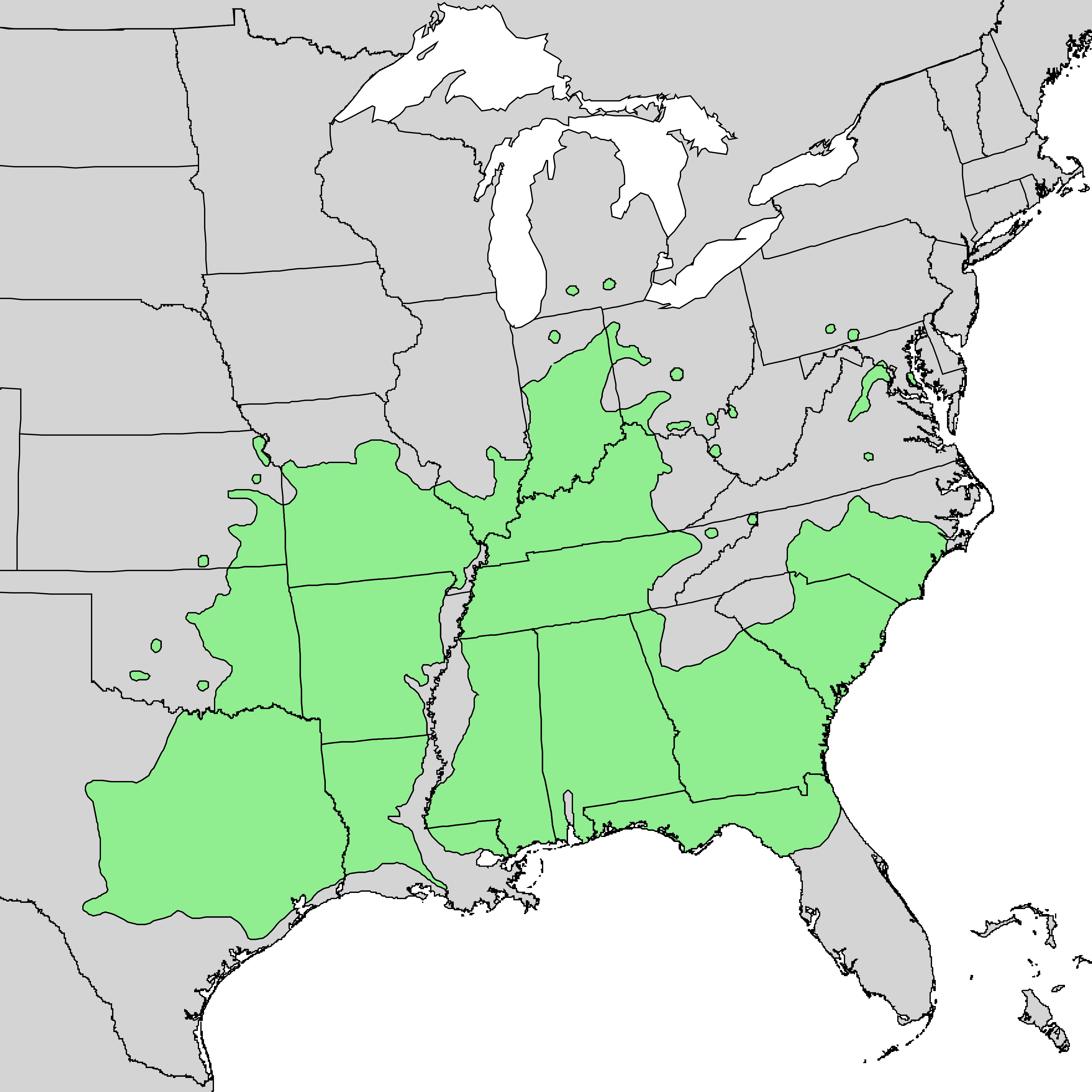
Quercus shumardii range map 1
Författare/Upphovsman:
U.S. Geological Survey
Kreditera:
Digital representation of "Atlas of United States Trees" by Elbert L. Little, Jr. [1]
Kort länk:
Källa:
Upplösning:
3516 x 3516 Pixel (201321 Bytes)
Beskrivning:
Range map of Quercus shumardi
Licens:
Public domain
Mer information om licensen för bilden finns här. Senaste uppdateringen: Thu, 26 Sep 2024 04:35:55 GMT