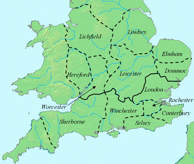
Offa dioceses
Författare/Upphovsman:
Kreditera:
Kort länk:
Källa:
Upplösning:
670 x 566 Pixel (178297 Bytes)
Beskrivning:
This map shows dioceses in England during the reign of Offa. The boundary between the archdioceses of Lichfield and Canterbury is shown in bold. Initially on w:en:Image:Offa dioceses.gif
Licens:
Public domain
Mer information om licensen för bilden finns här. Senaste uppdateringen: Wed, 20 Sep 2023 21:09:05 GMT