NapoleonicWars
Författare/Upphovsman:
Tillskrivning:
Bilden är taggad "Attribution Required" men ingen tillskrivningsinformation lämnades. Attributionsparametern utelämnades troligen när MediaWiki-mallen användes för CC-BY-licenserna. Författare och upphovsmän hittar ett exempel för korrekt användning av mallarna här.
Kreditera:
Eget arbete
Kort länk:
Källa:
Upplösning:
1357 x 628 Pixel (53488 Bytes)
Beskrivning:
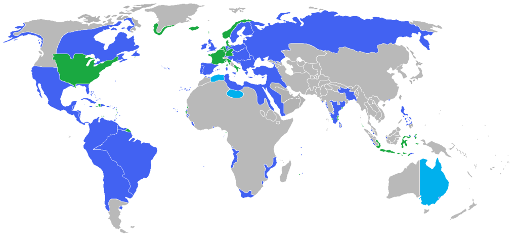
Locator map of the competing sides of the Napoleonic Wars before outset of the war (early 1800s). [Which year exactly?!]
Blue: Great Britain, Prussia, Austria, Russia, Portugal, Spain, Sweden, Ottoman Empire with more. Green: France, French client states in Europe, Denmark-Norway, and the United States. Light blue: New South Wales, British claimed territory; Fezzan, Ottoman vassal; and the eastern "Barbary States" of Algiers, Tunis, and Tripoli nominally Ottoman governed.
Licens:
Licensvillkor:
Creative Commons Attribution 3.0
Mer information om licensen för bilden finns här. Senaste uppdateringen: Mon, 15 Apr 2024 21:46:01 GMT
