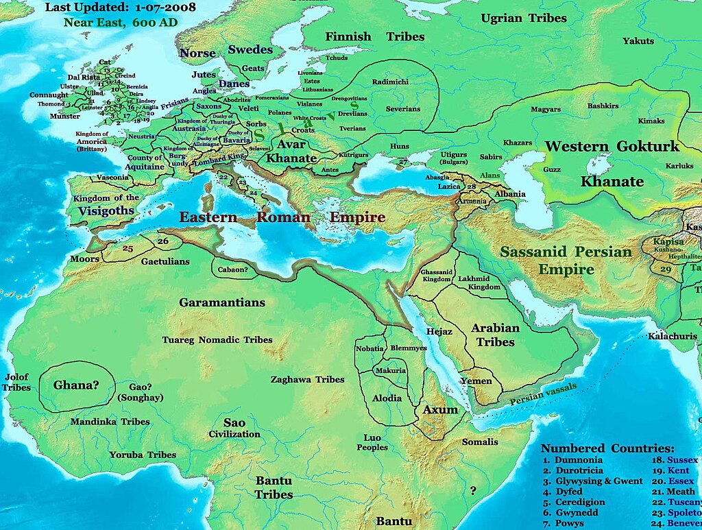
NE 600ad
Description: This image is a zoomed-in version of the Eastern Hemisphere in 600 AD.
Author: Thomas A. Lessman (talessman@yis.us), later modified by others.
Source URL: http://www.worldhistorymaps.info/images/East-Hem_600ad.jpg.
Image Summary:Created by Thomas Lessman, based on this map of Eastern Hemisphere in 600 AD. Free for educational use. If you use this image, please credit the author (Thomas Lessman) and include (Source URL: http://www.worldhistorymaps.info/images/East-Hem_600ad.jpg). If you can help improve this map, please contact Thomas Lessman at talessman@yis.us.
Other Historical Maps by Thomas Lessman
| Maps of the eastern hemisphere showing history
Bold dates are available on Wikimedia or Wikipedia. | ||
| Primeval | ||
| Ancient
|
·| 600 BC | 550 BC | 527 BC | 500 BC |
400 BC | ·| 1 AD | 50 AD | 100 AD | 200 AD | 300 AD | | |
| Medieval |
·| 500 AD | 565 AD | 600 AD | 700 AD | | |
| Modern |
·| 1500 AD | · * For historical maps of the whole world, | |
| Upphovsrätt kan inte tillämpas på detta verk som därmed hamnar i public domain; detta på grund av att verket enbart består av information som är allmän egendom och saknar verkshöjd. |
Mer information om licensen för bilden finns här. Senaste uppdateringen: Fri, 16 Aug 2024 20:53:54 GMT
