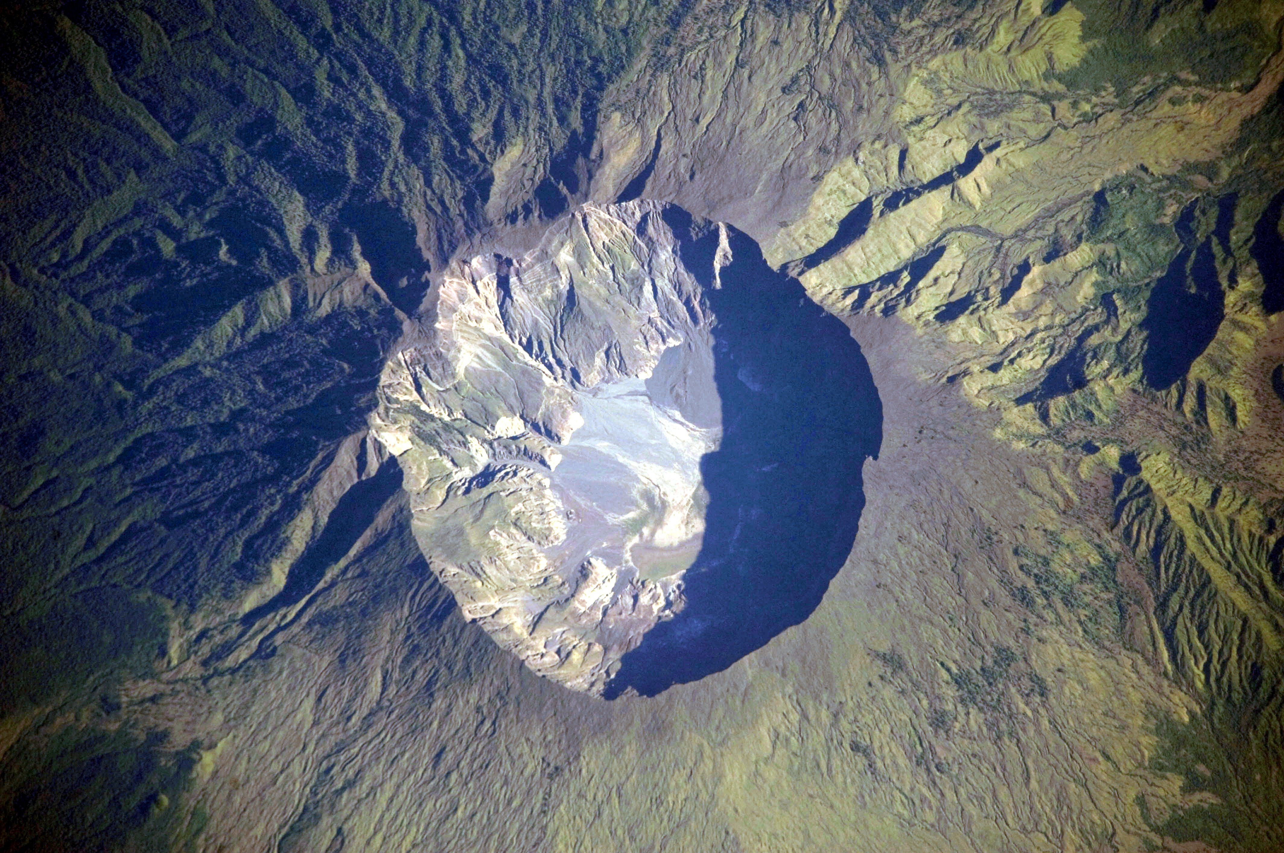
Mount Tambora Volcano, Sumbawa Island, Indonesia
Författare/Upphovsman:
This image was taken by the NASA Expedition 20 crew.
Kreditera:
Image and and English description: Mount Tambora Volcano, Sumbawa Island, Indonesia, NASA Earth Observatory. 2nd version: Överförd från de.wikipedia till Commons.; originally from https://eol.jsc.nasa.gov/SearchPhotos/photo.pl?mission=ISS020&roll=E&frame=06563
Kort länk:
Källa:
Upplösning:
4256 x 2828 Pixel (2401508 Bytes)
Beskrivning:
This detailed astronaut photograph depicts the summit caldera of the volcano. The huge caldera—6 kilometers in diameter and 1,100 meters deep—formed when Tambora’s estimated 4,000-meter-high peak was removed, and the magma chamber below emptied during the 1815 eruption. Today the crater floor is occupied by an ephemeral freshwater lake, recent sedimentary deposits, and minor lava flows and domes emplaced during the nineteenth and twentieth centuries. Layered tephra deposits are visible along the north-western crater rim. Active fumaroles, or steam vents, still exist in the caldera.
Licens:
Public domain
Mer information om licensen för bilden finns här. Senaste uppdateringen: Mon, 30 Sep 2024 00:18:49 GMT